Exploring the Neahkahnie Coast
I was determined to find a way to the water somewhere along the Neahkahnie Coastline between Short Sands Beach in Smuggler’s Cove and Neahkahnie Beach by Manzanita.
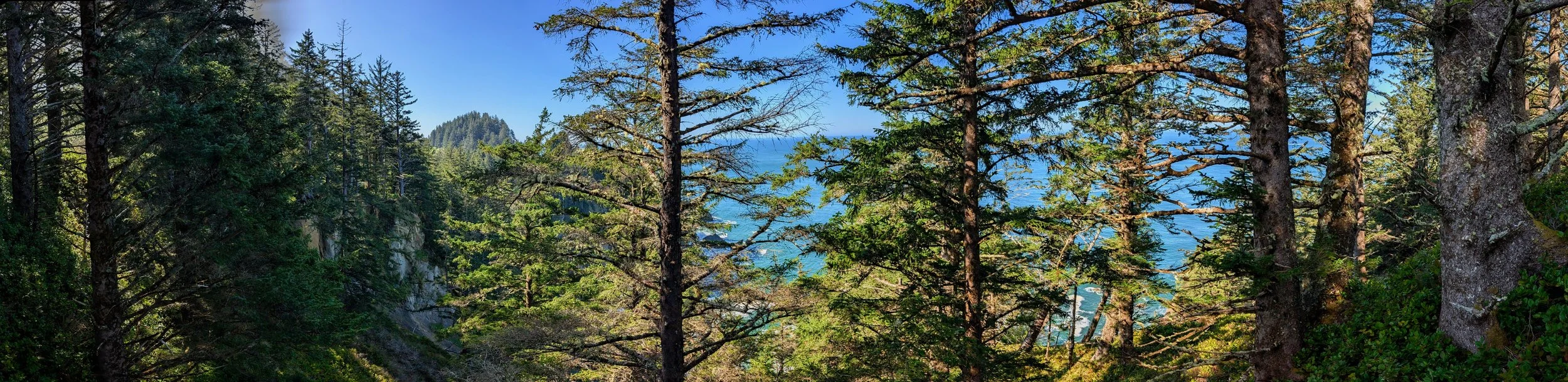
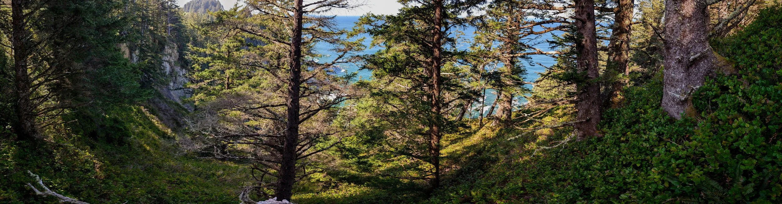
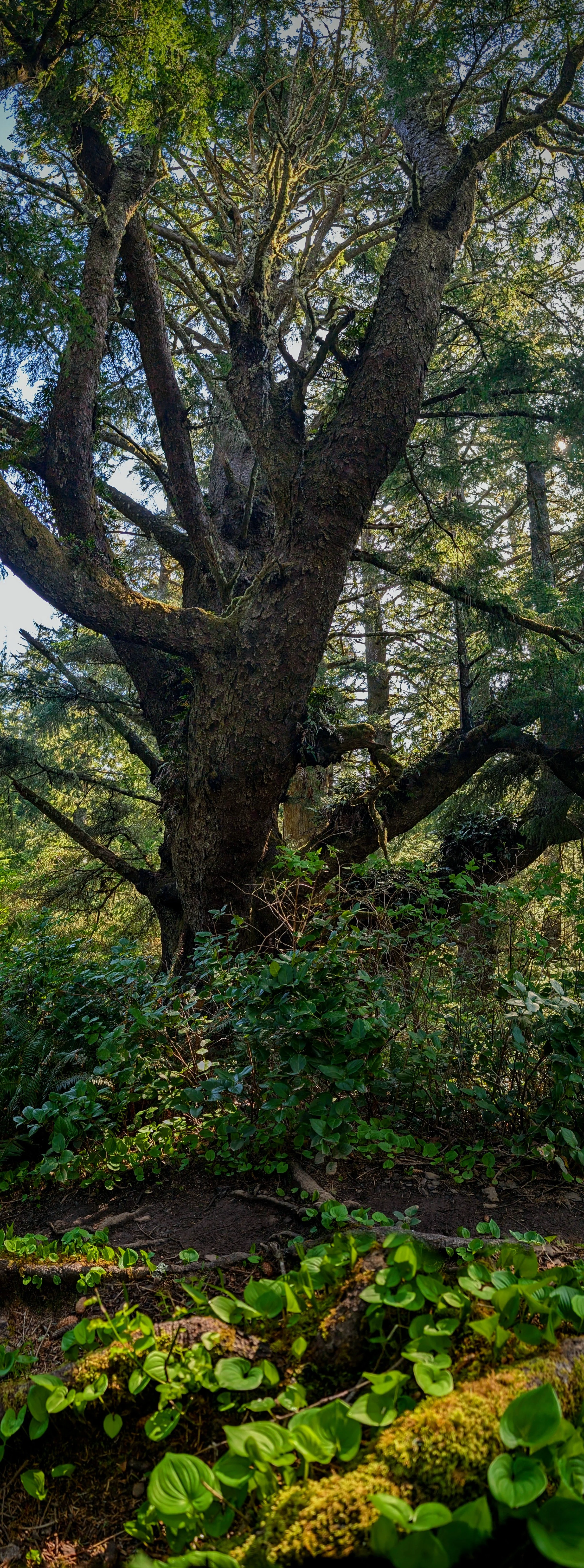
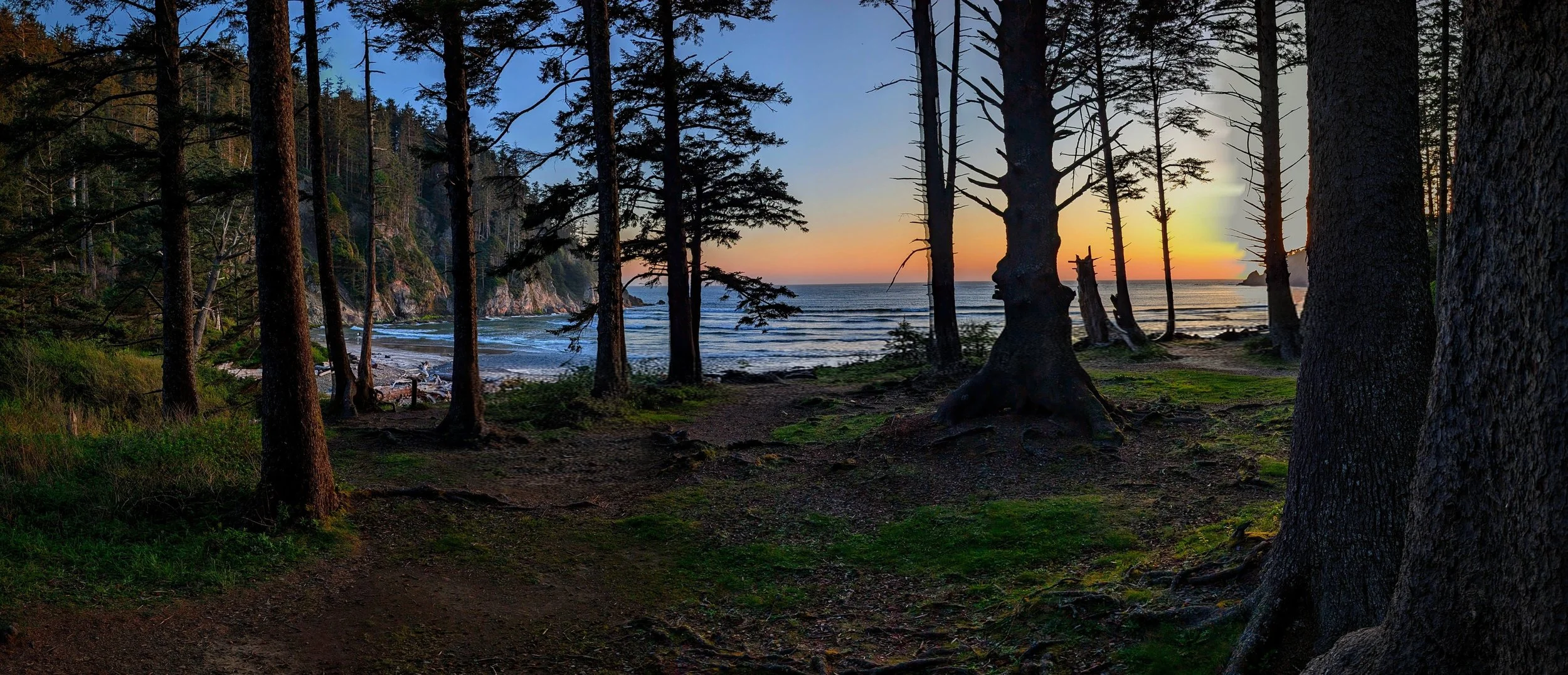
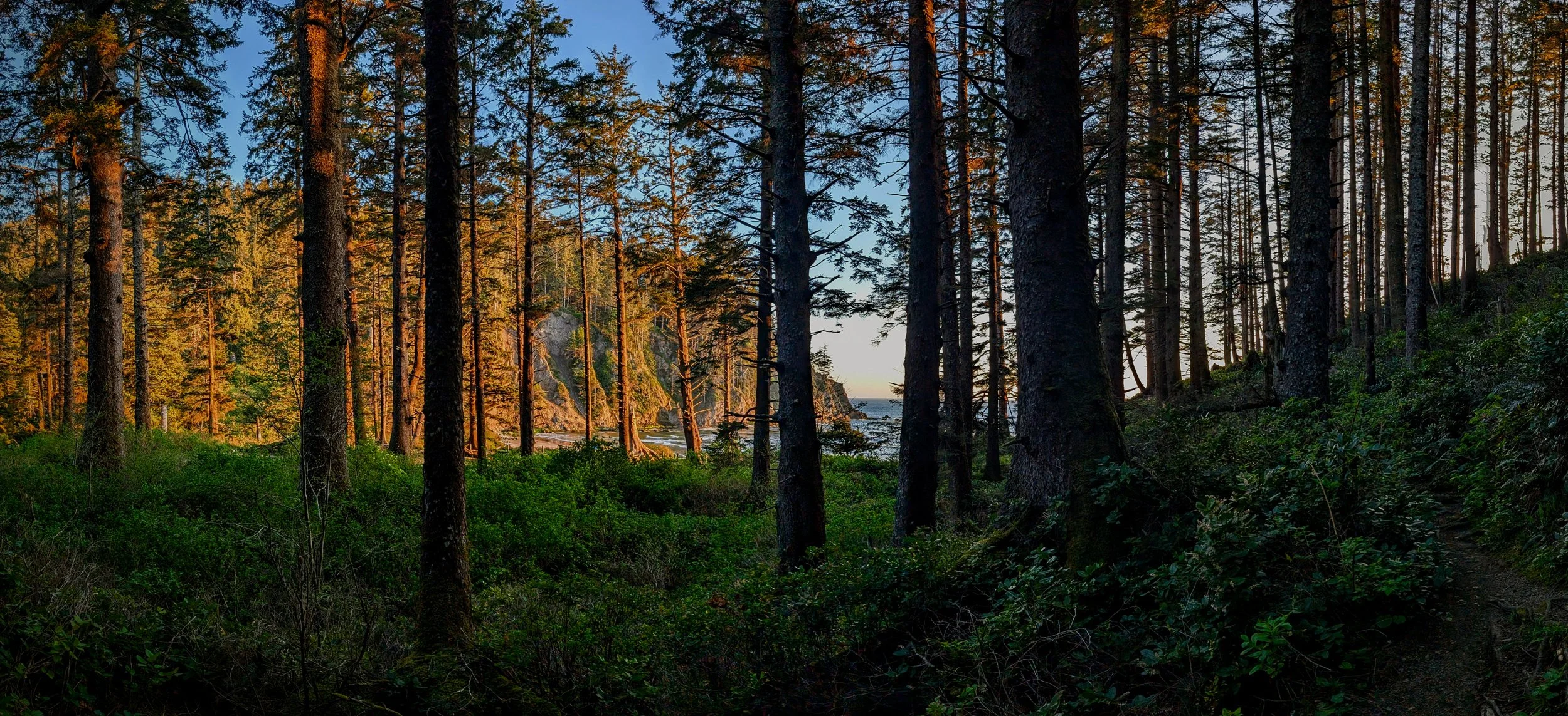
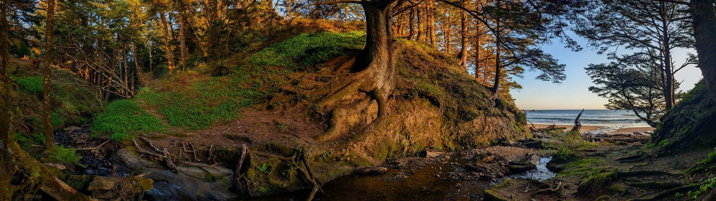
I started at the Necarney Creek Trailhead and took the Necarney Creek Trail down towards Short Sands Beach. Just before you get to the beach there used to be a picturesque suspension bridge going across Necarney Creek. That bridge has washed entirely out, but there is a log crossing that isn’t bad at all. Once on the other side of Necarney Creek the Elk Flats Trail is in good repair. I took it on up up up the hill, checking out any side trails that seemed to go anywhere (they didn’t go anywhere, except maybe to some campsites).
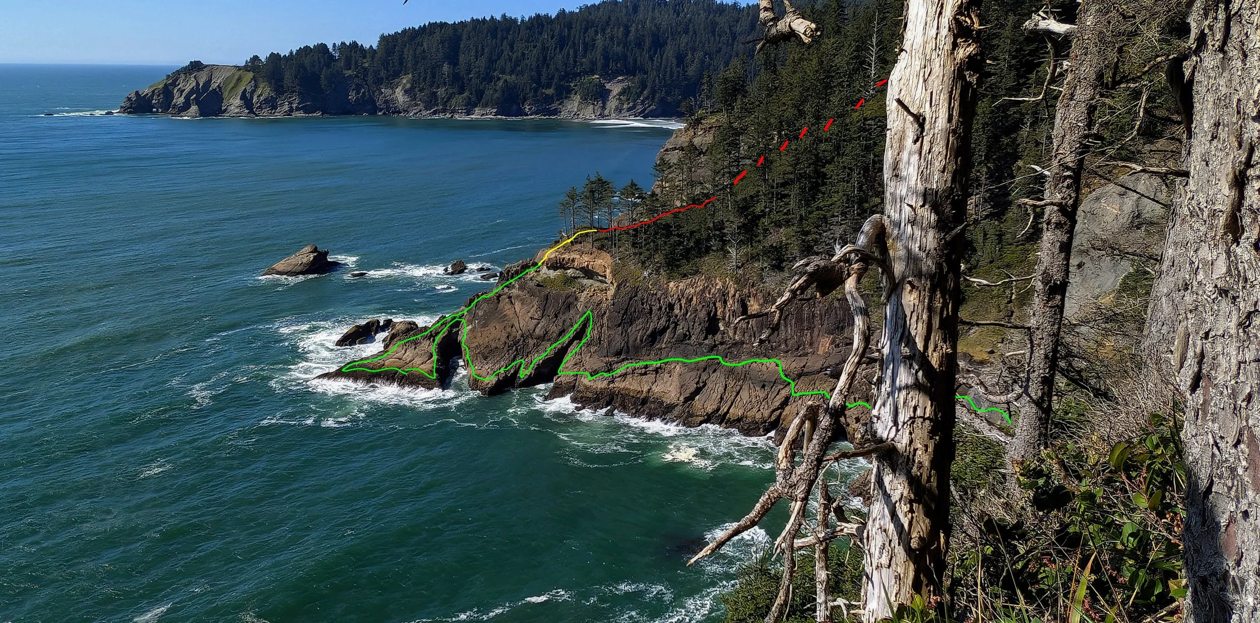
About the time the trail leveled out it seemed to me that there could be a place where beach cold be reached. However, right at the place I would have left the trail to start exploring toward to the water there was a MASSIVE blowdown that made it impossible to go anywhere west of the trail. So I continued south and before long I saw another side trail heading west. I took that trail and it came to an overlook where I could see down a cliff toward the water. It was clear I wasn’t going to make it down the cliff, but I could see a hill with vegetation that looked like it might get me down to the water. So I worked my way around the cliff, and over to the hill. The little side trail seemed like it was coming with me at first. But before long I lost it and proceeded to bushwack my way down down down the hill. It was NOT easy going. In fact it was some of the densest bushwack I’ve ever done. I don’t know what plant it was growever everywhere, but it did NOT like me being there.
I wished I had long sleeves. I also wished I had thicked pants. My shins got all bange dup and my arms got very scratched. Every now and then there were blackberry vines grabbing my legs, which I would have to break through. I also had poison oak rashes a few days later, which I assume came from this bushwack.
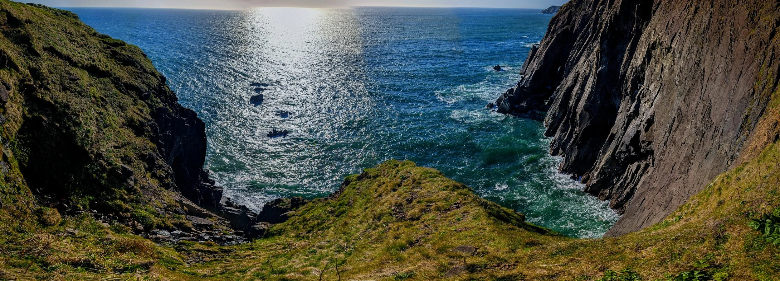
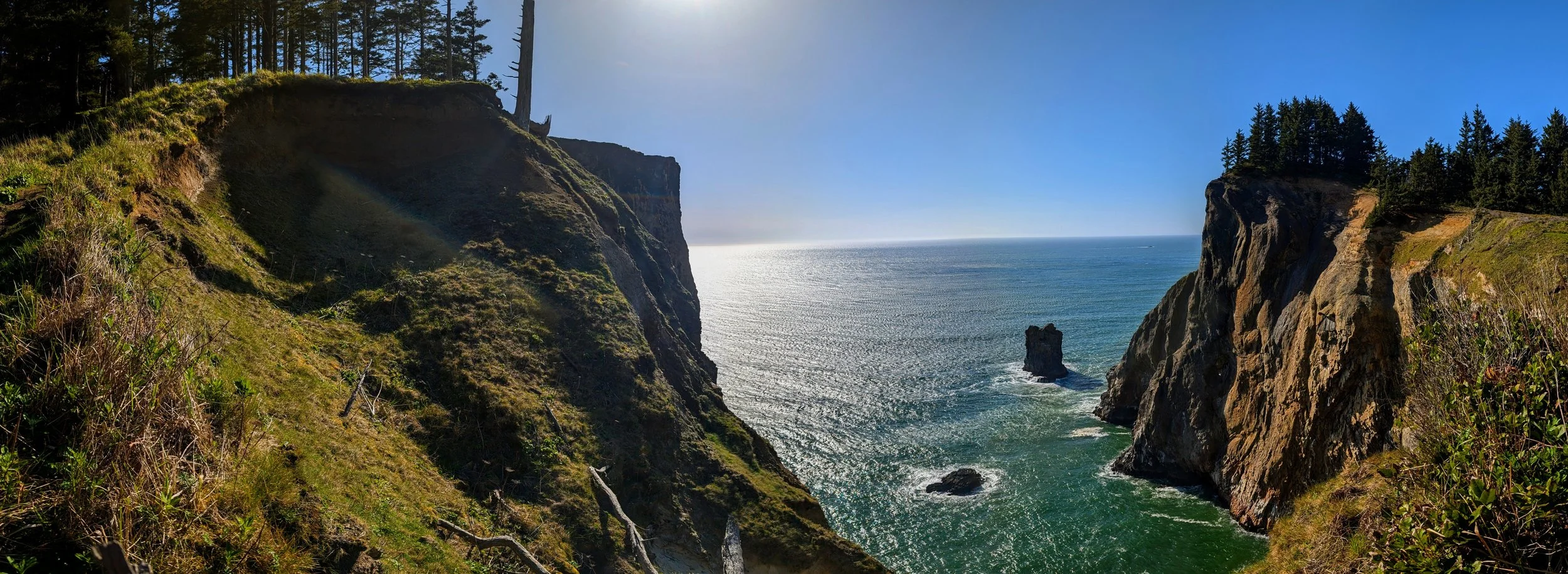
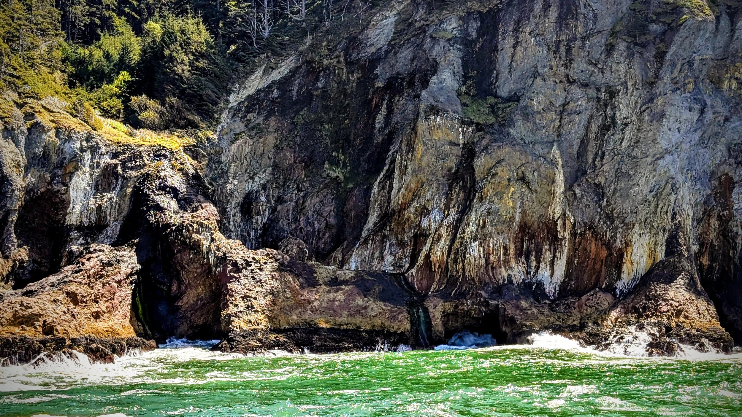
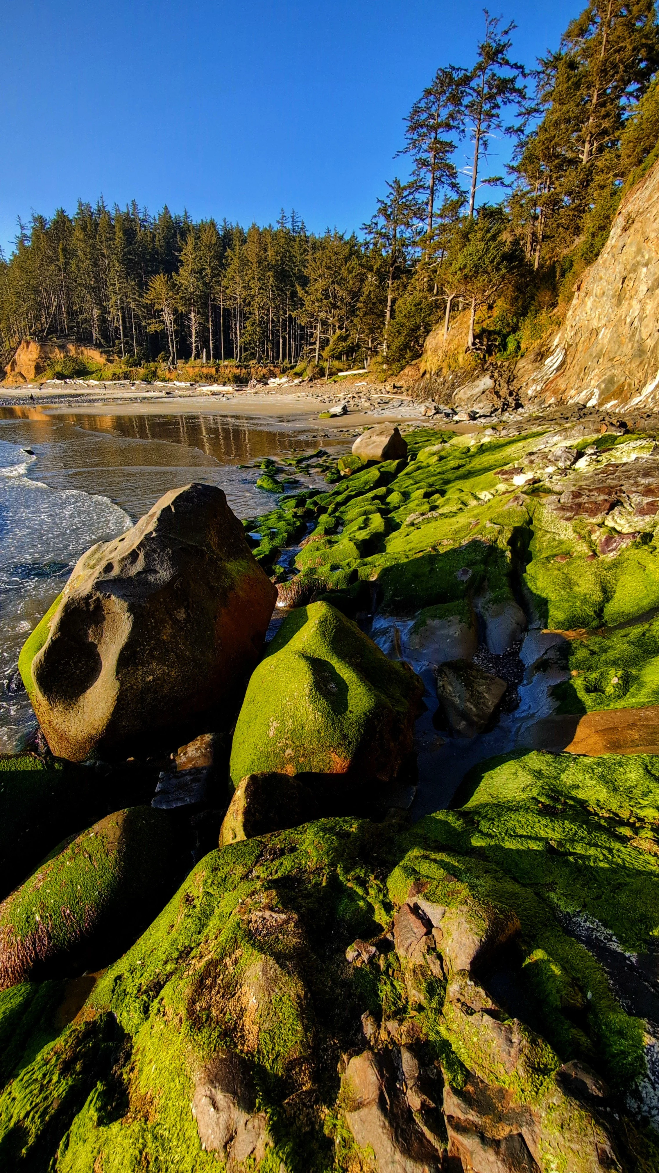
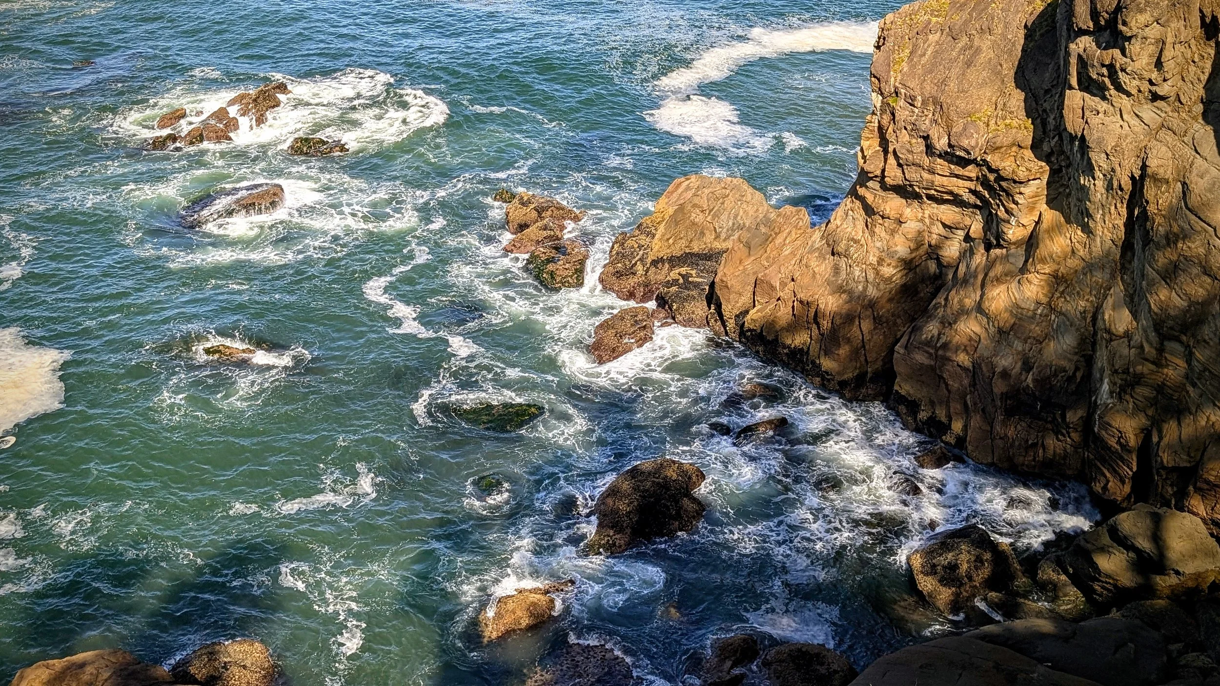
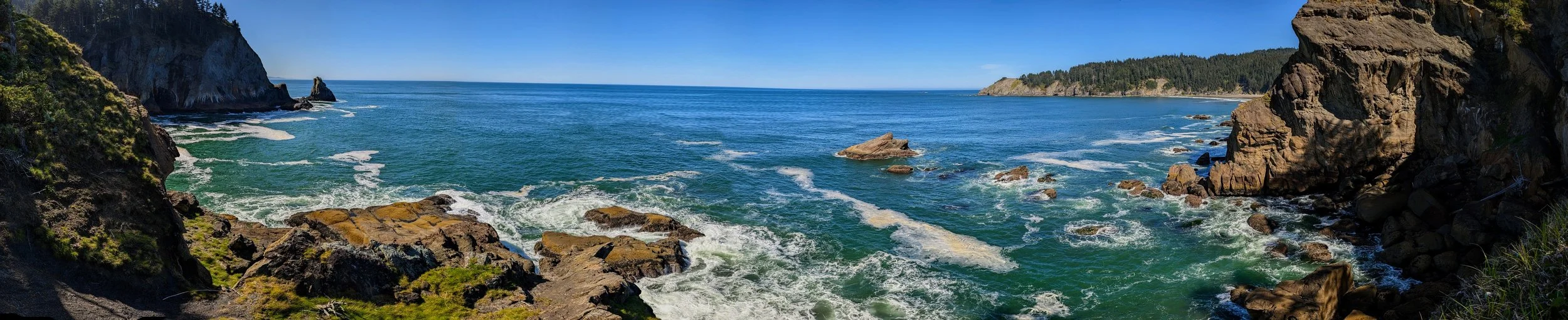
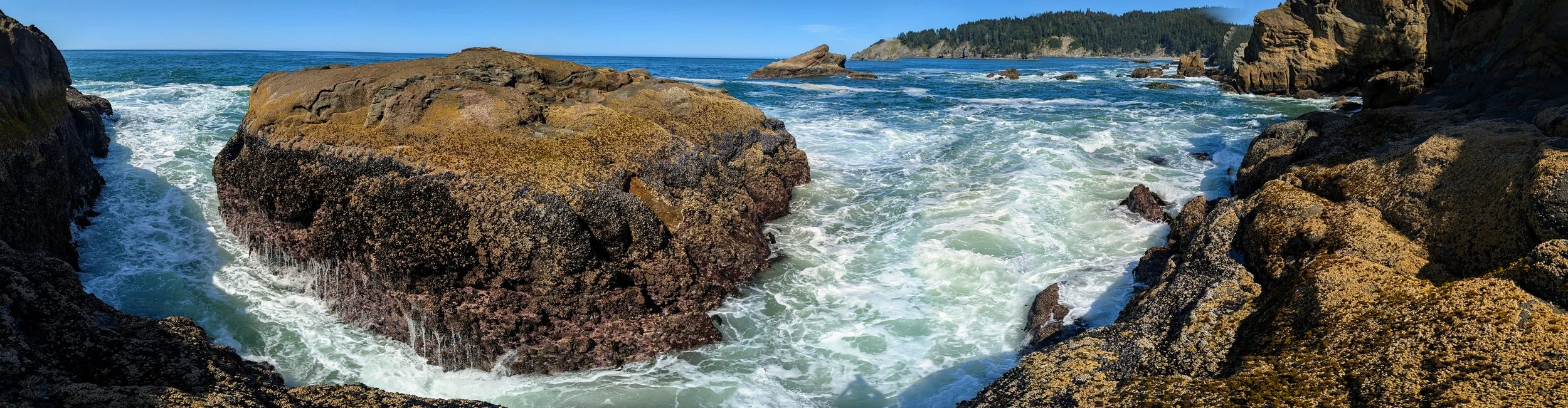
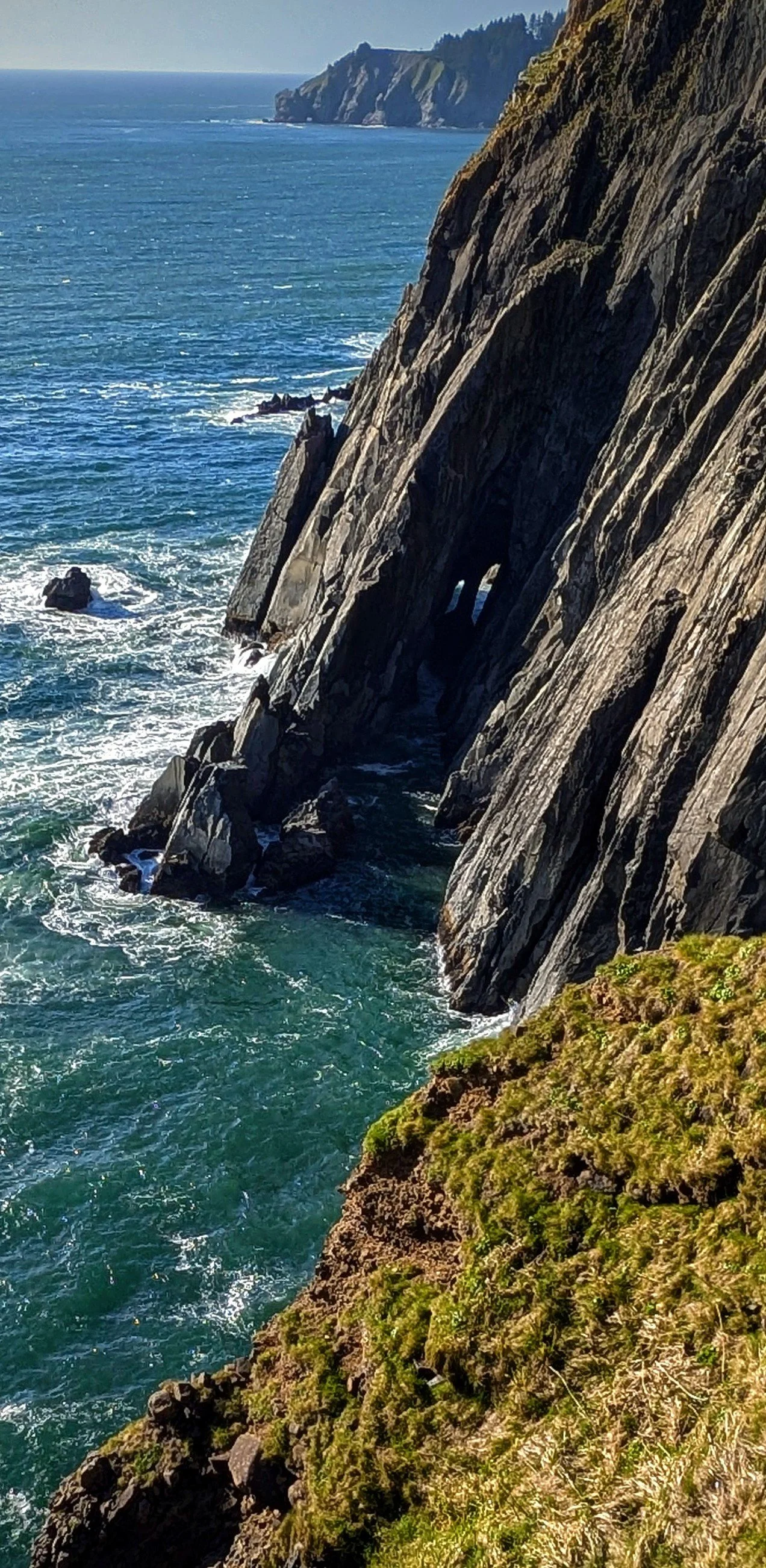
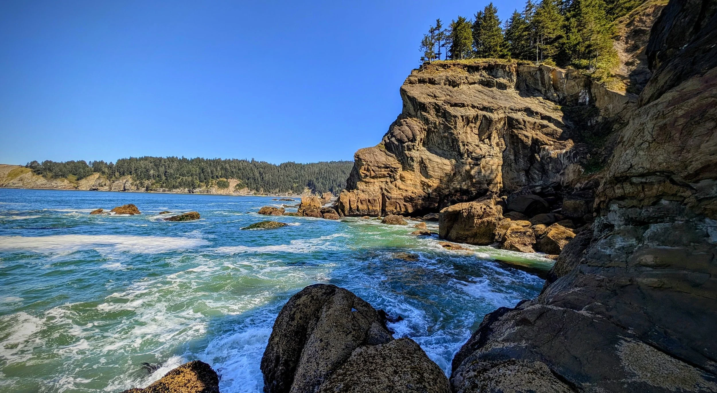
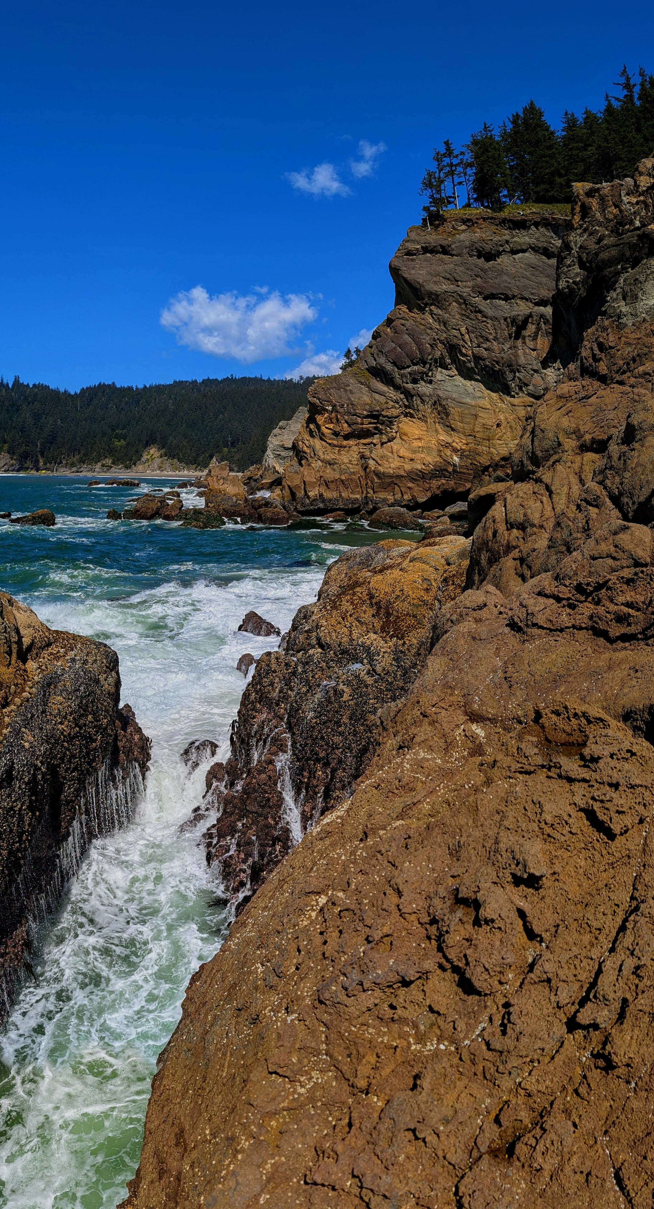
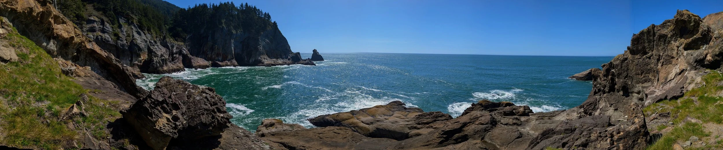
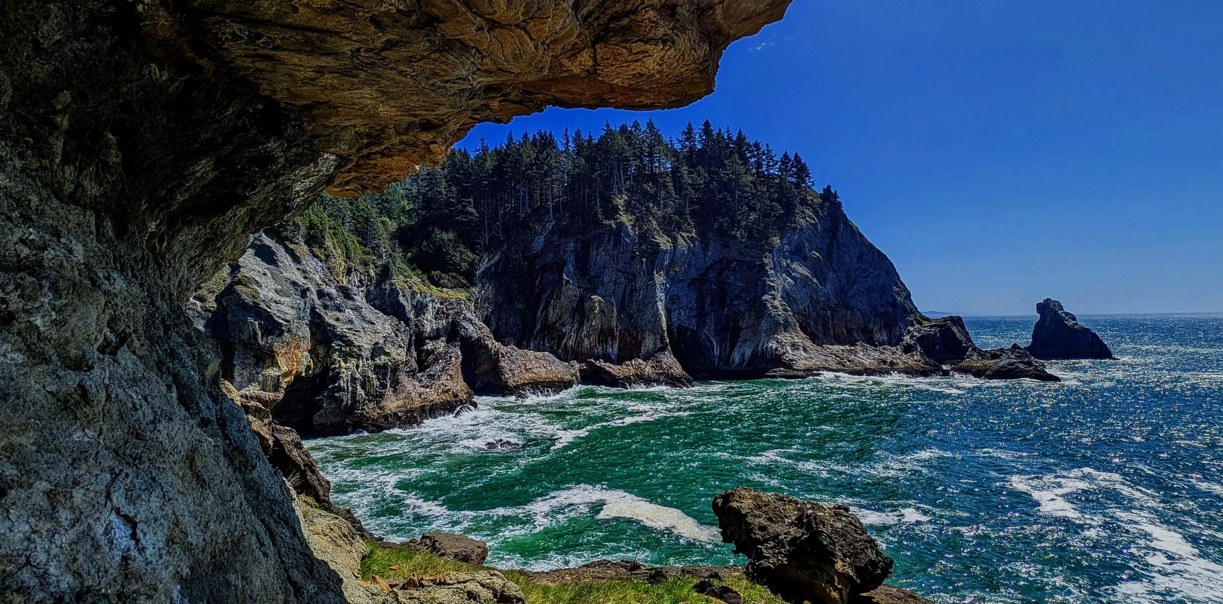
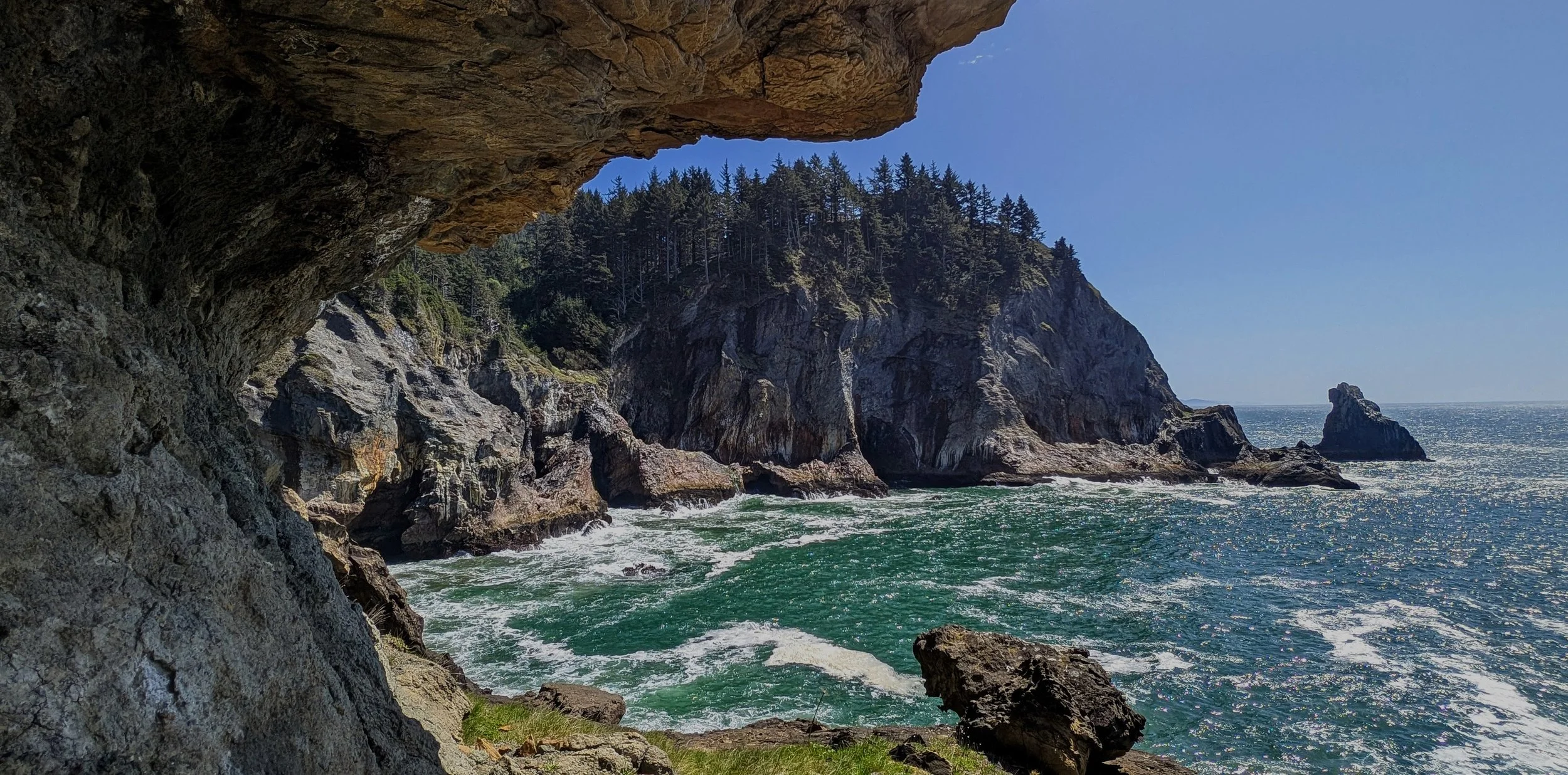
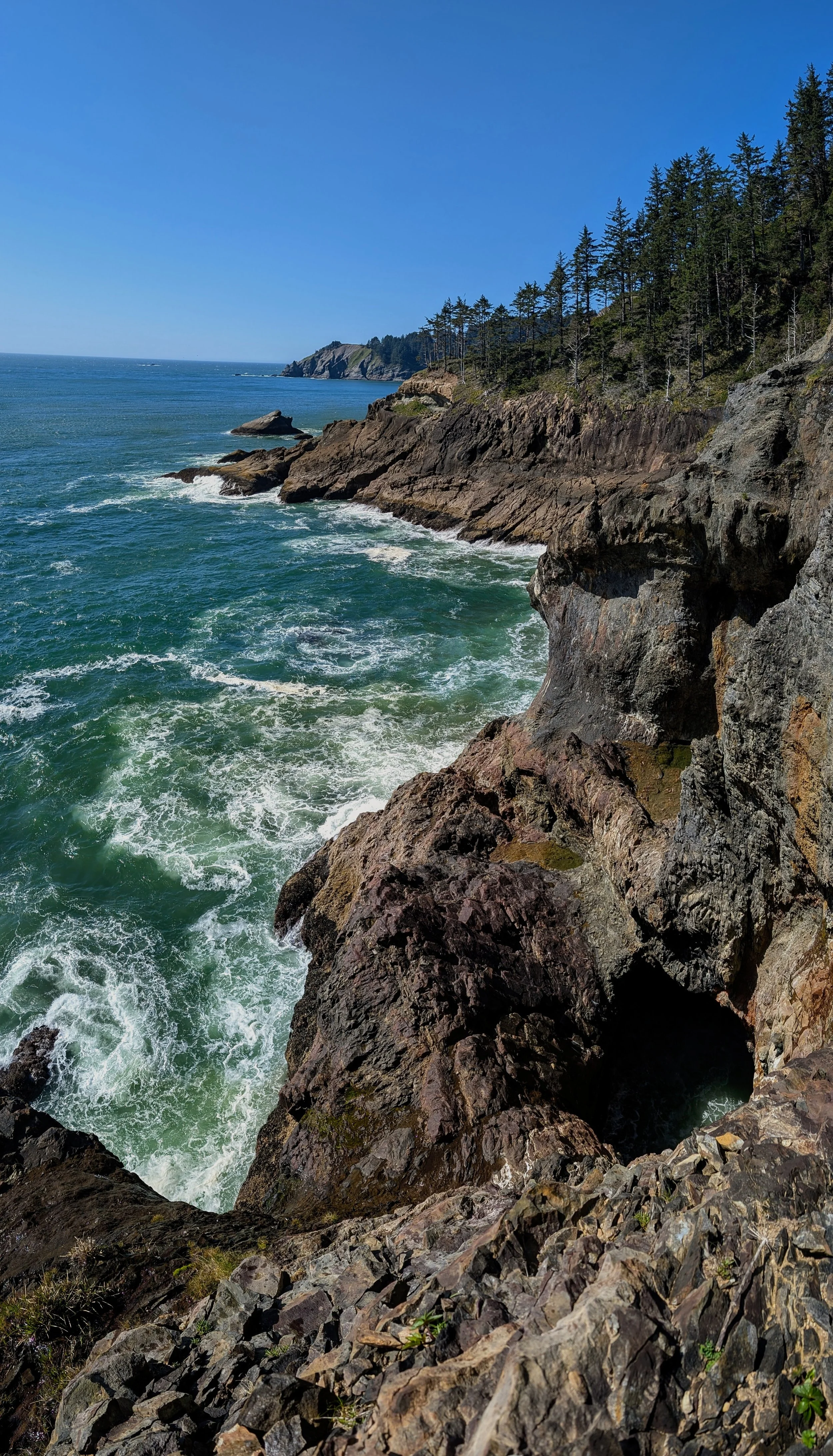
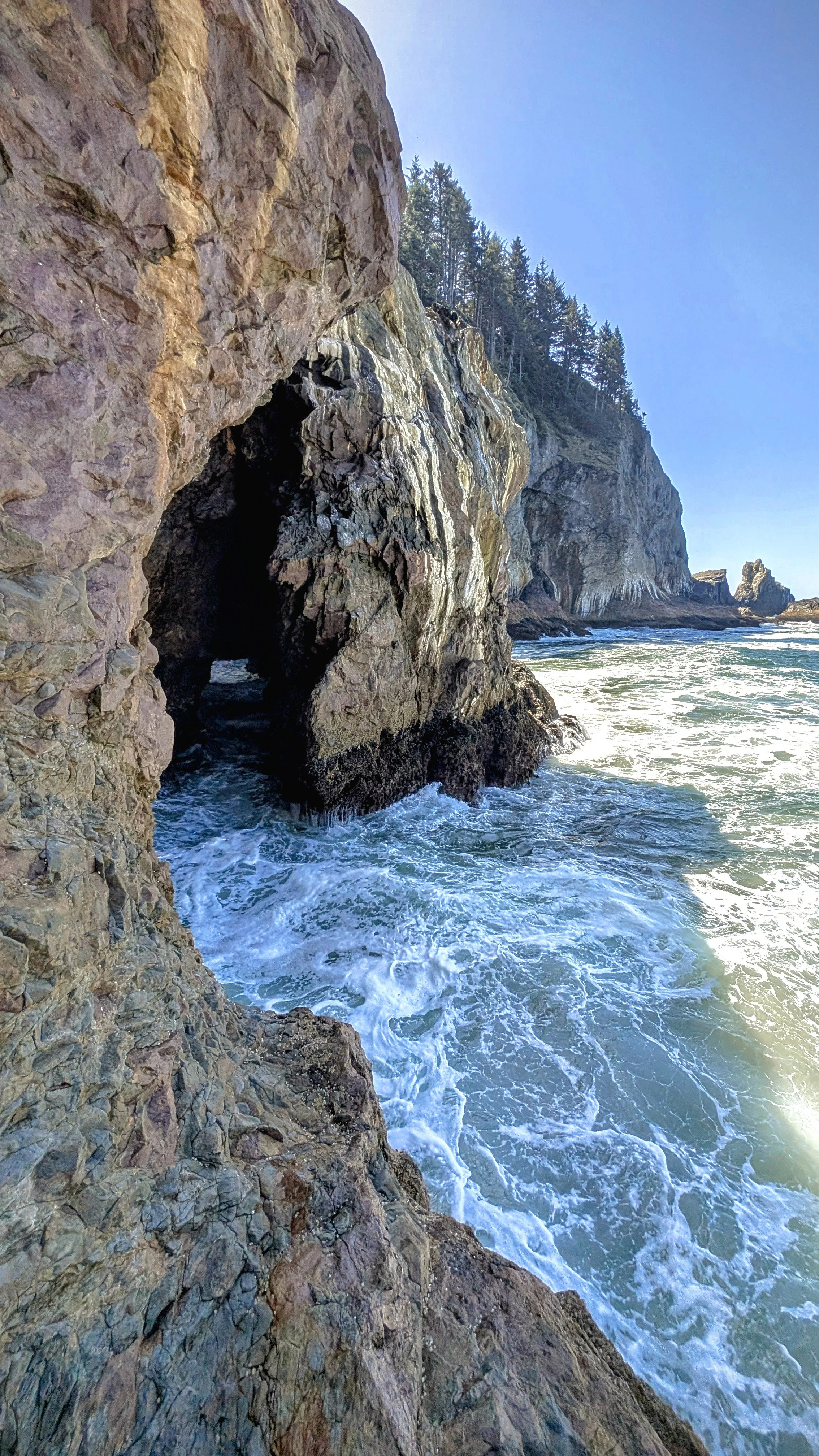
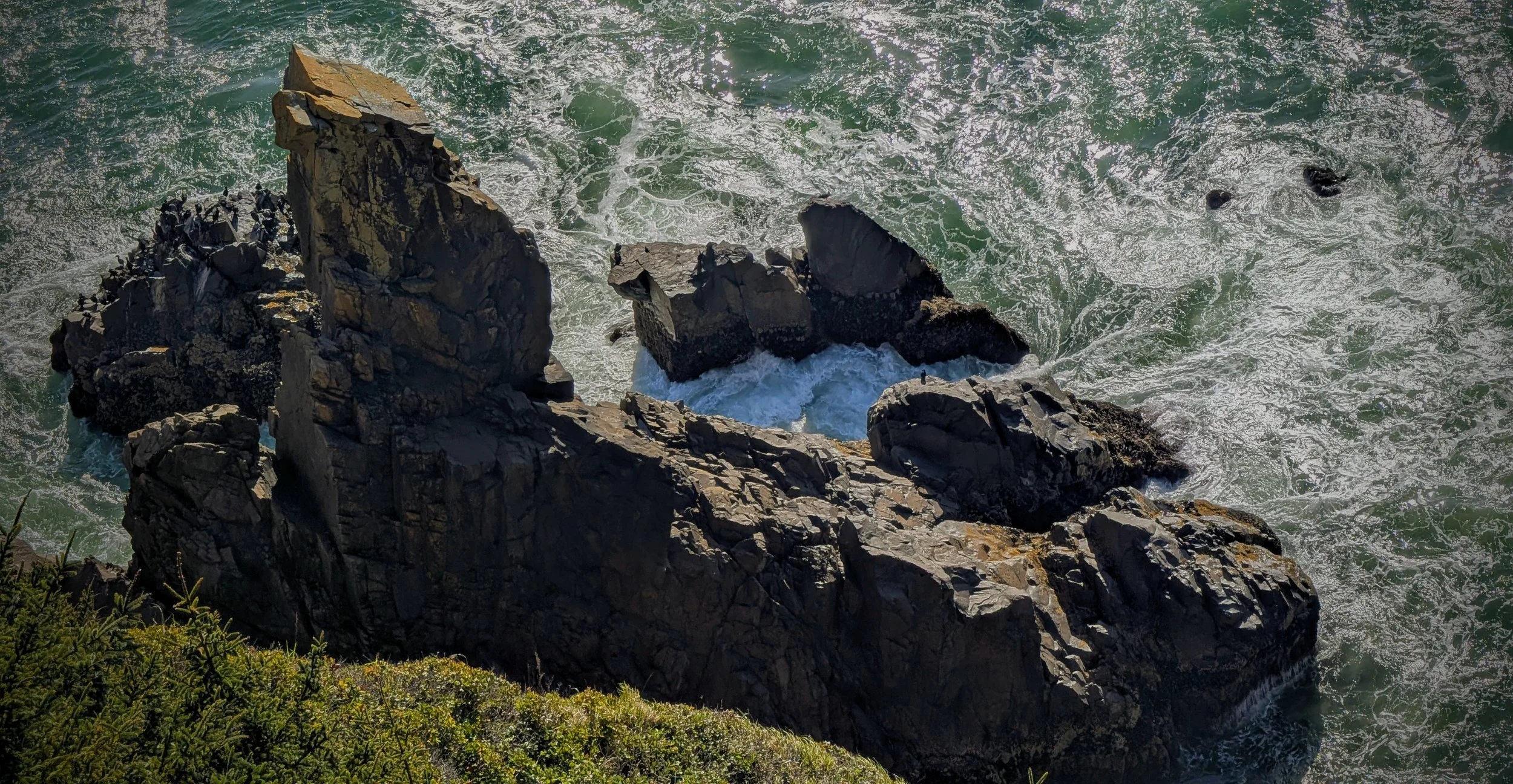
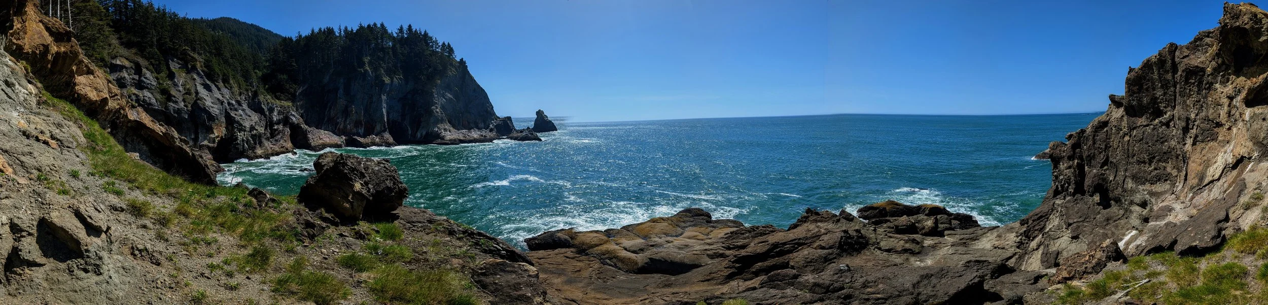
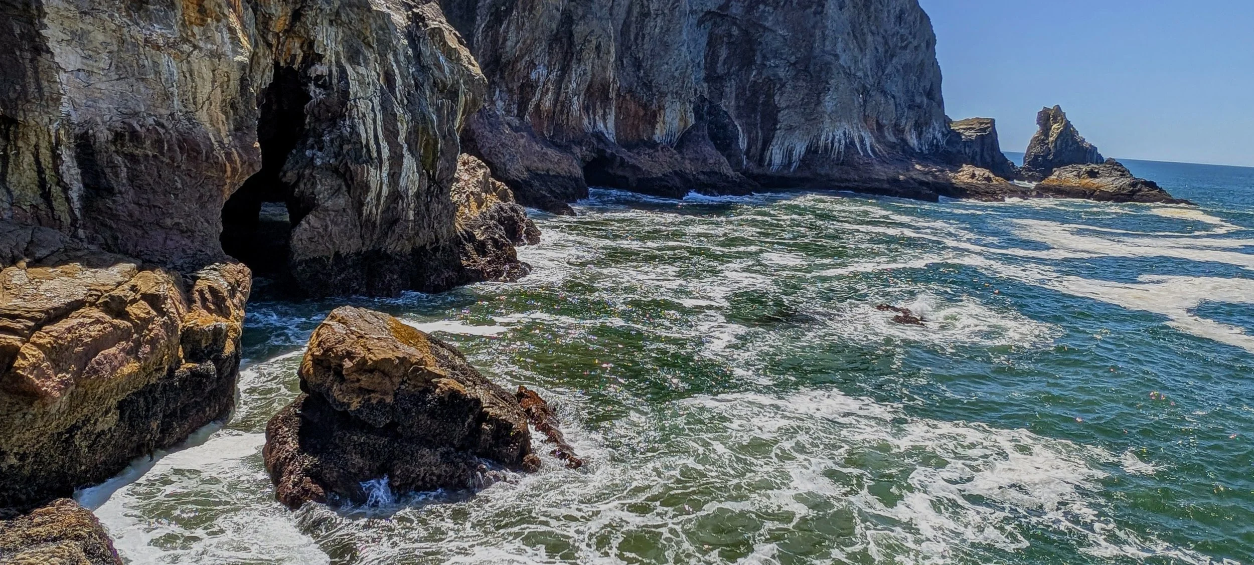
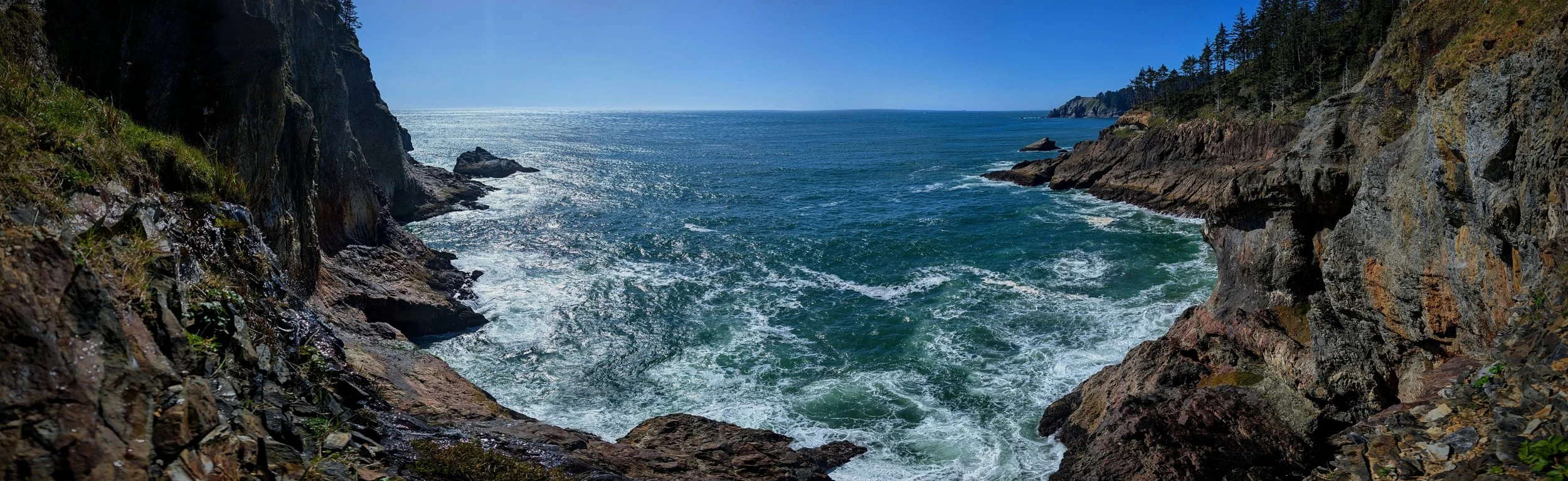
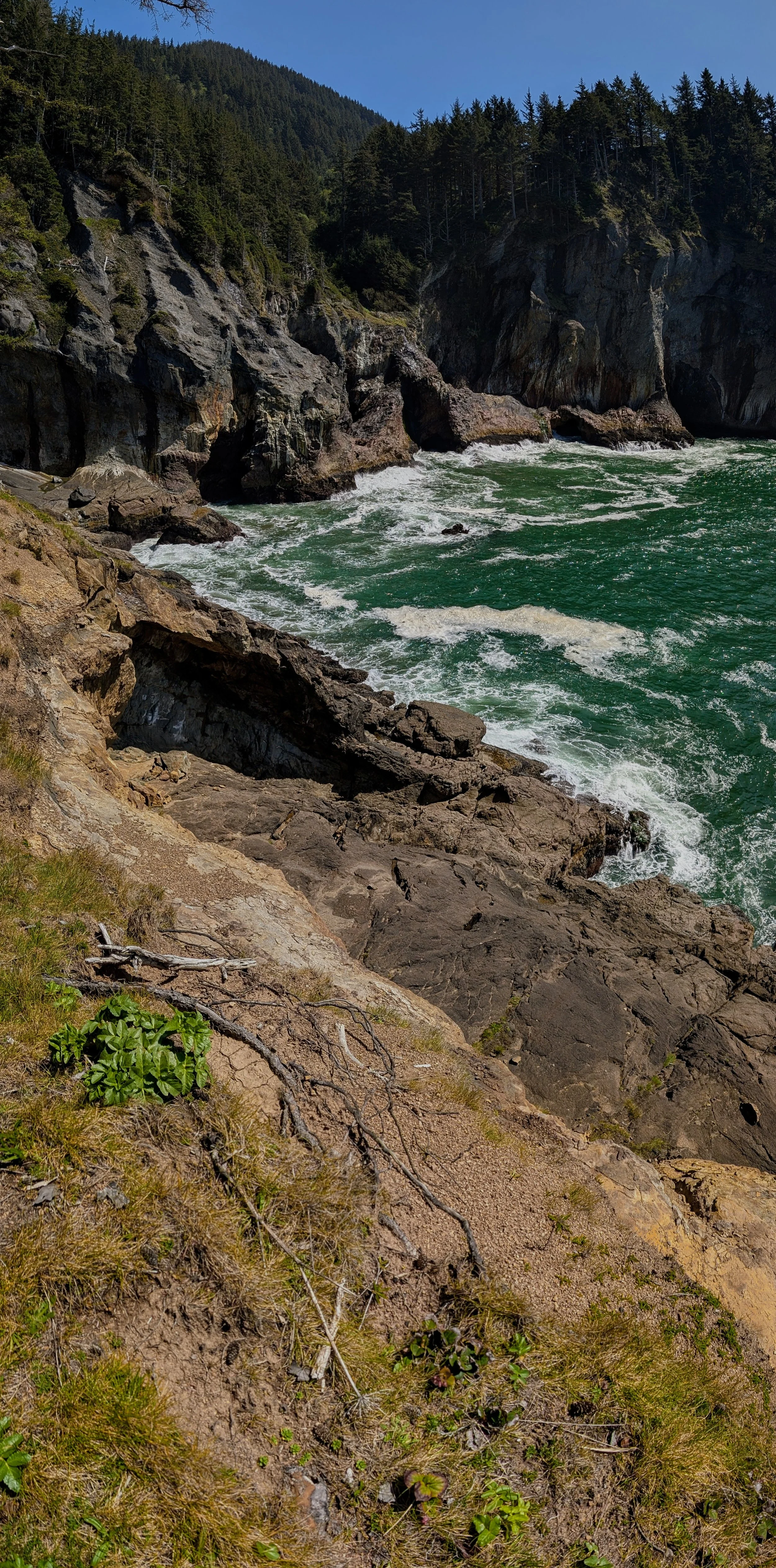
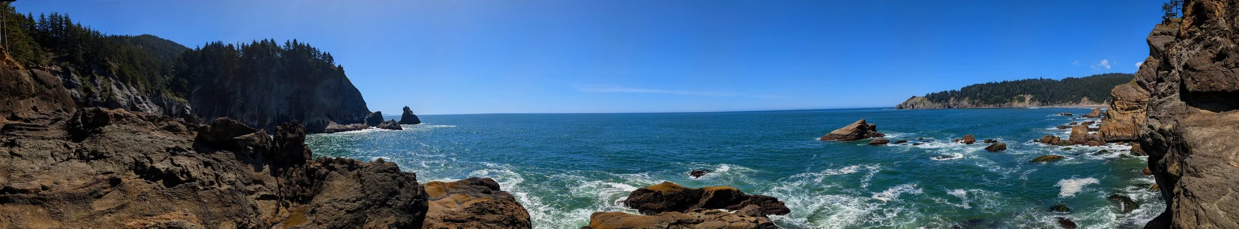
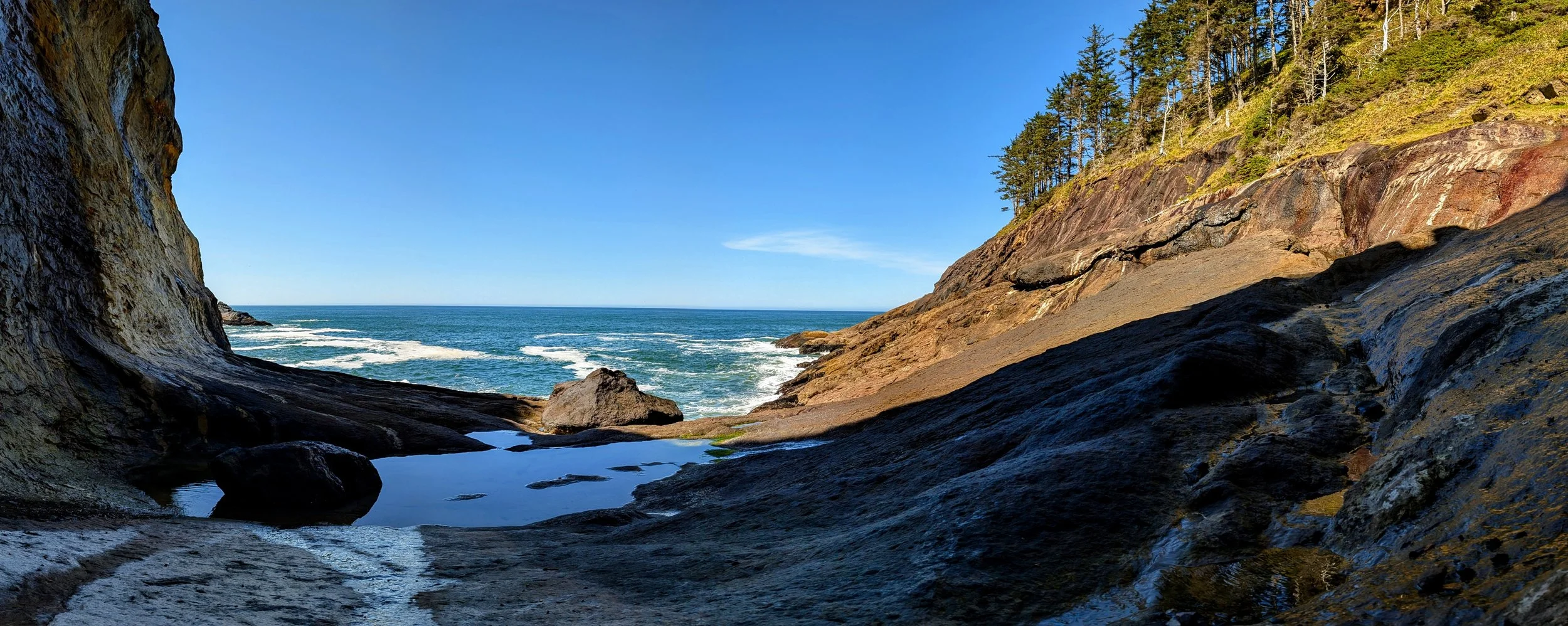
Anyway, i did eventually reach the volcanic shelf at the water on the north side of what is labeled “Devil’s Cauldron” on the maps. The next inlet south of this is called “Treasure Cove” on the maps, but I often hear people refer to it as Devil’s Cauldron, and I even read somewhere that some people say the names should be switched. I think I agree with that. This cove/inlet/whatever didn’t seem at all like a cauldron, but Treasure Cove seems like a great name for it. Anyway, i’ll call this cove Devil’s Cauldron. It’s lined on three sides by rock, and the north side it the only place you can get to without ropes.
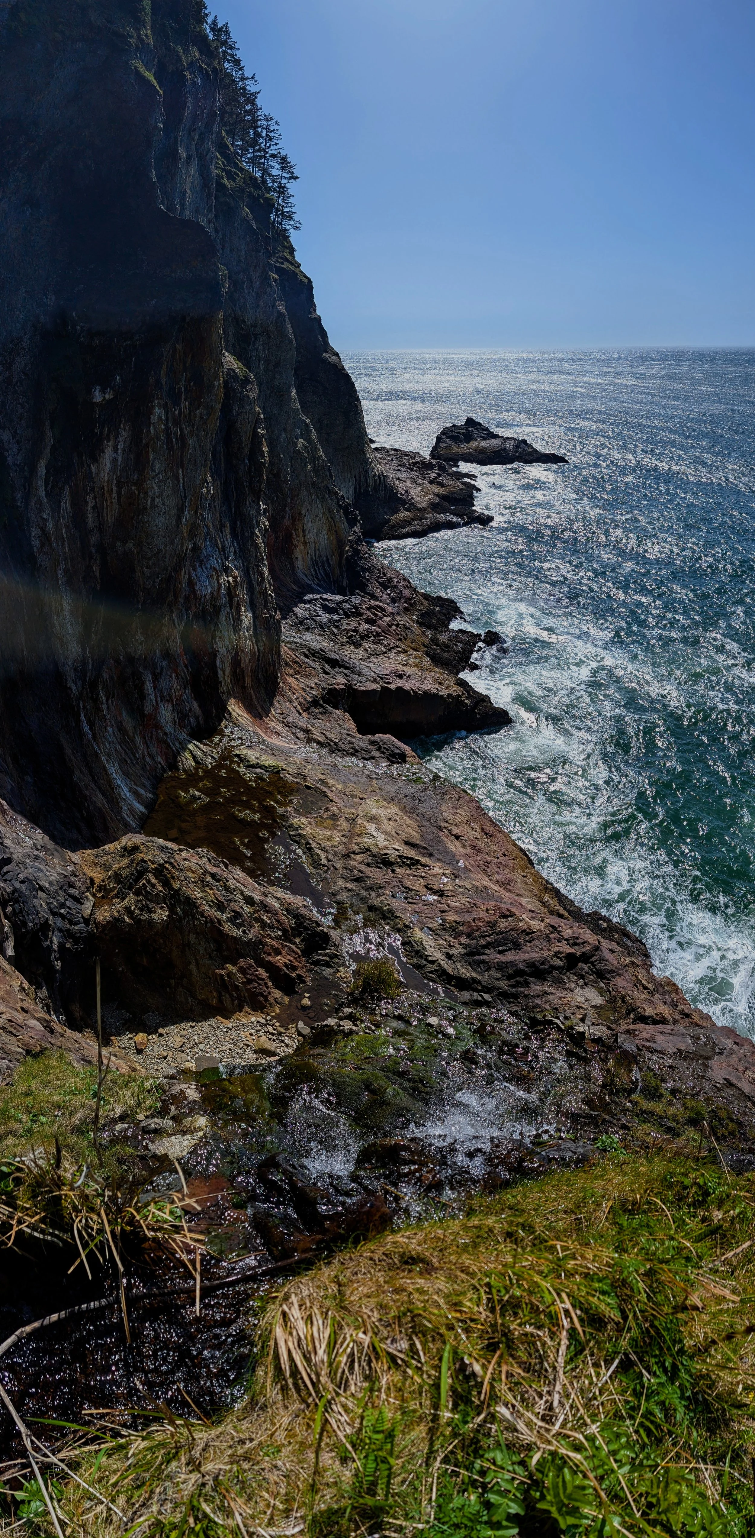
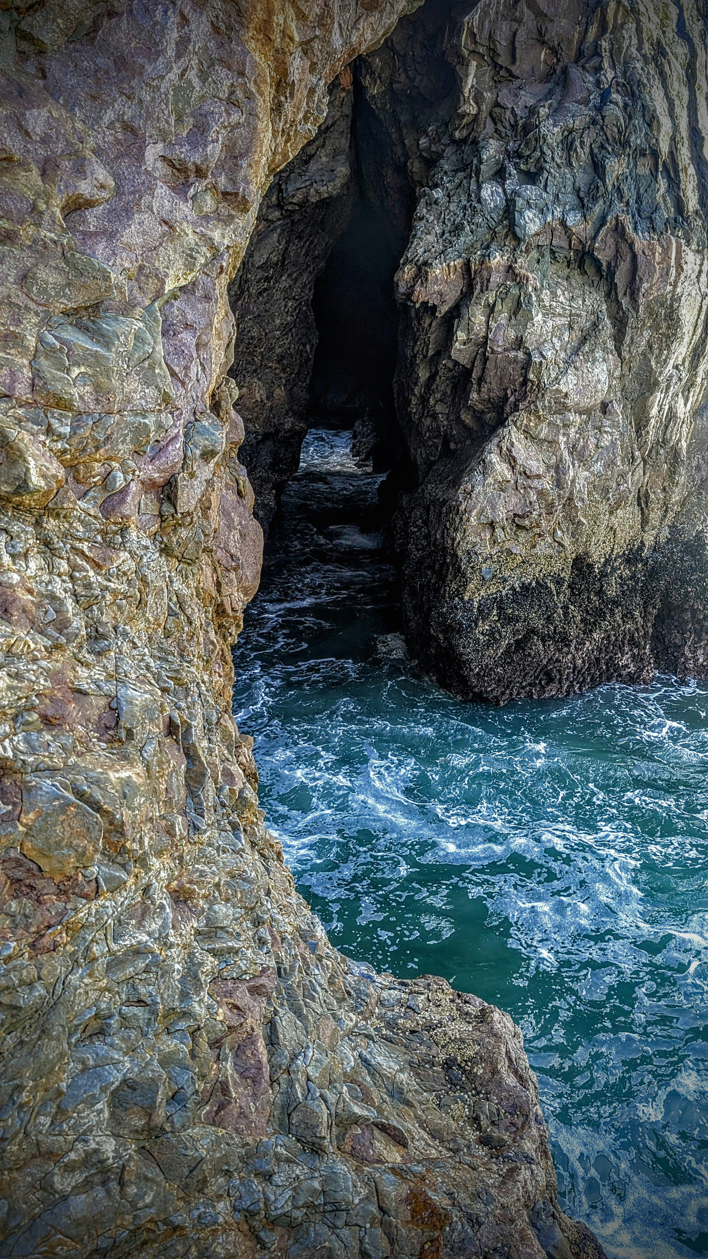
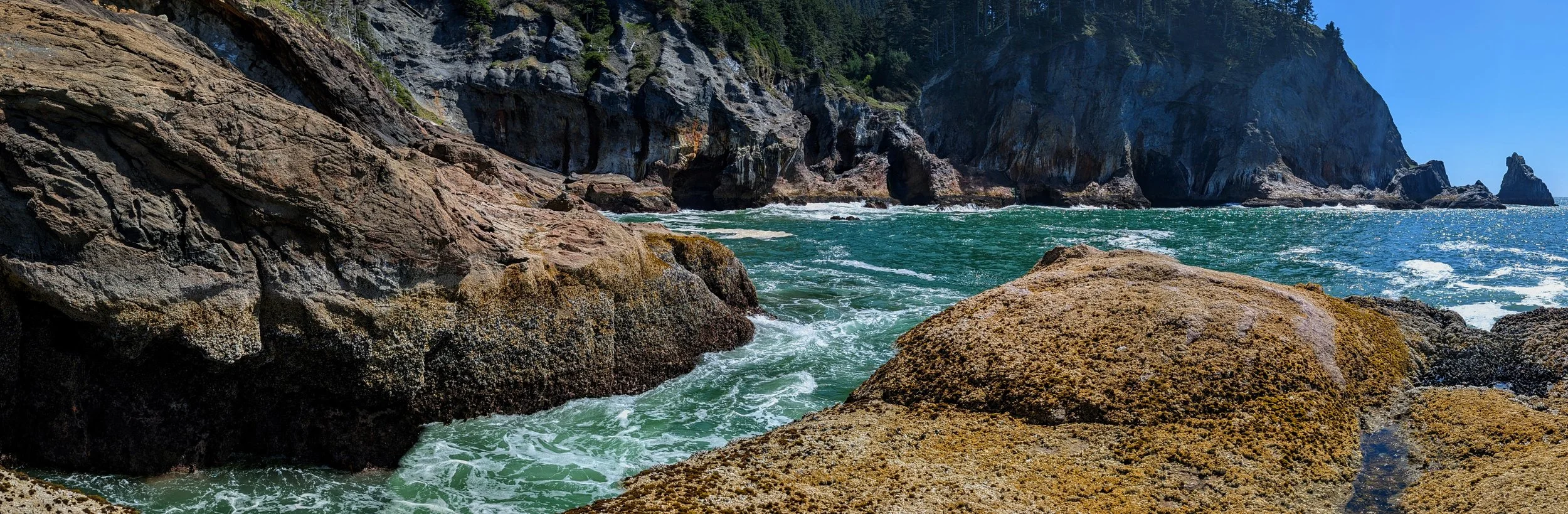
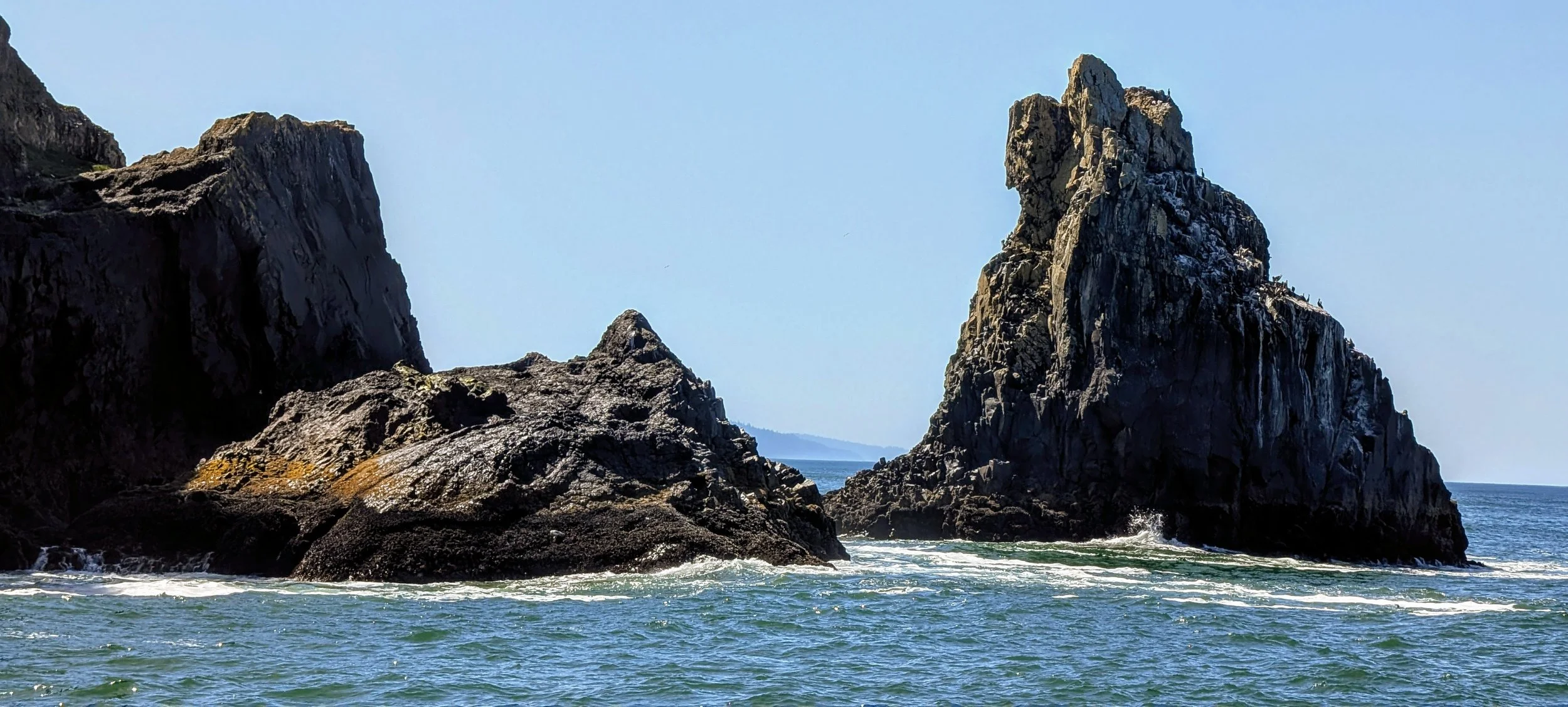
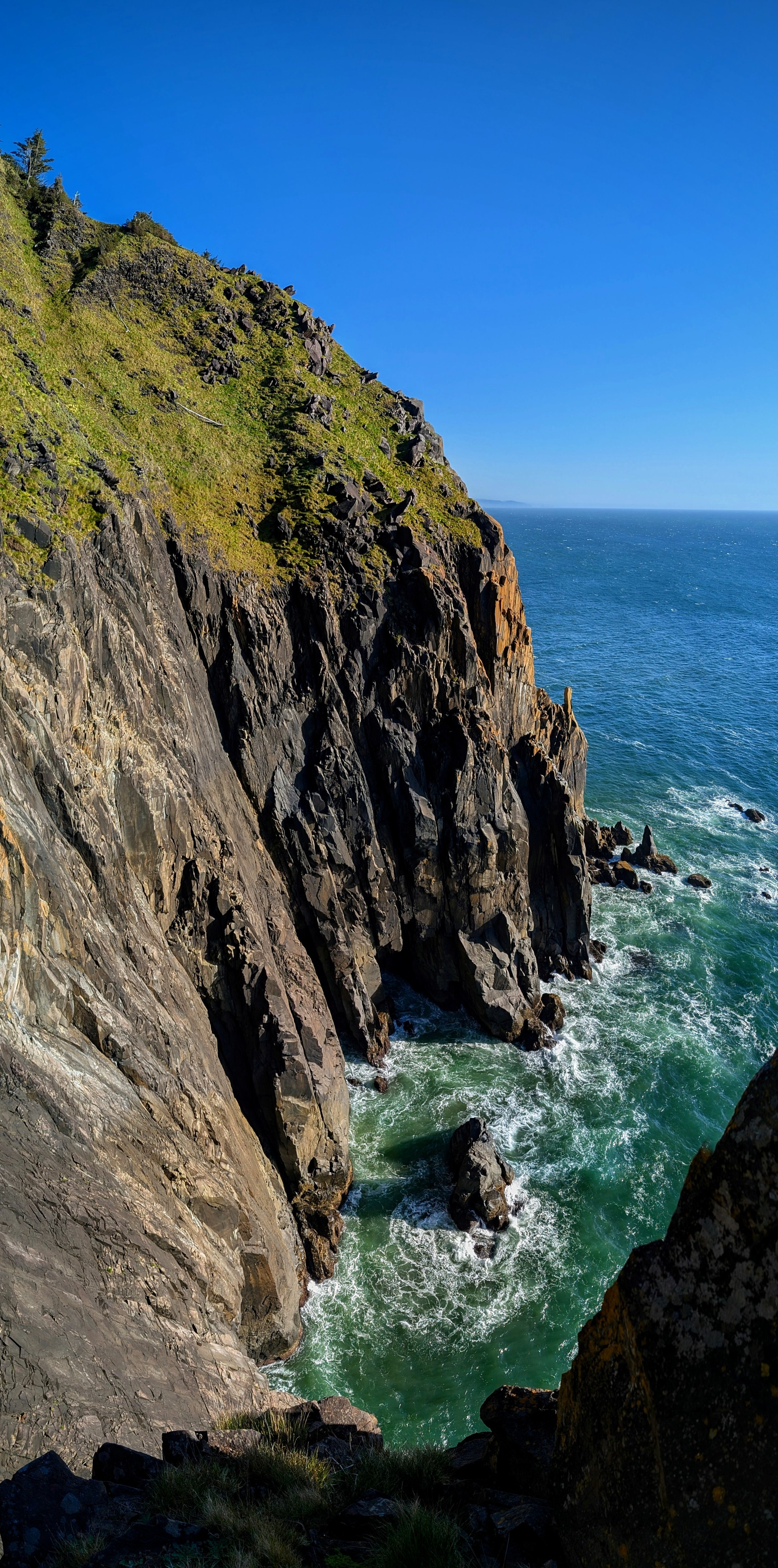
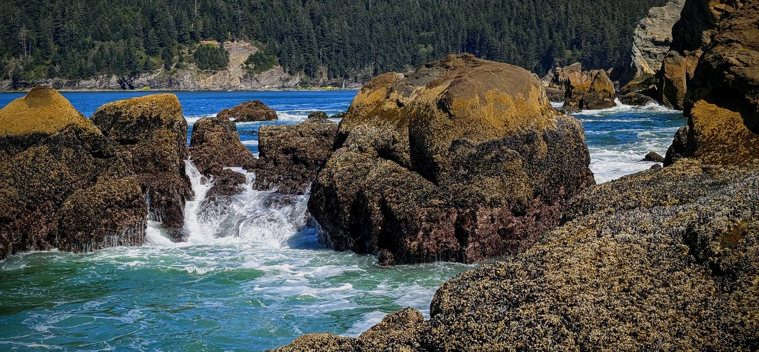
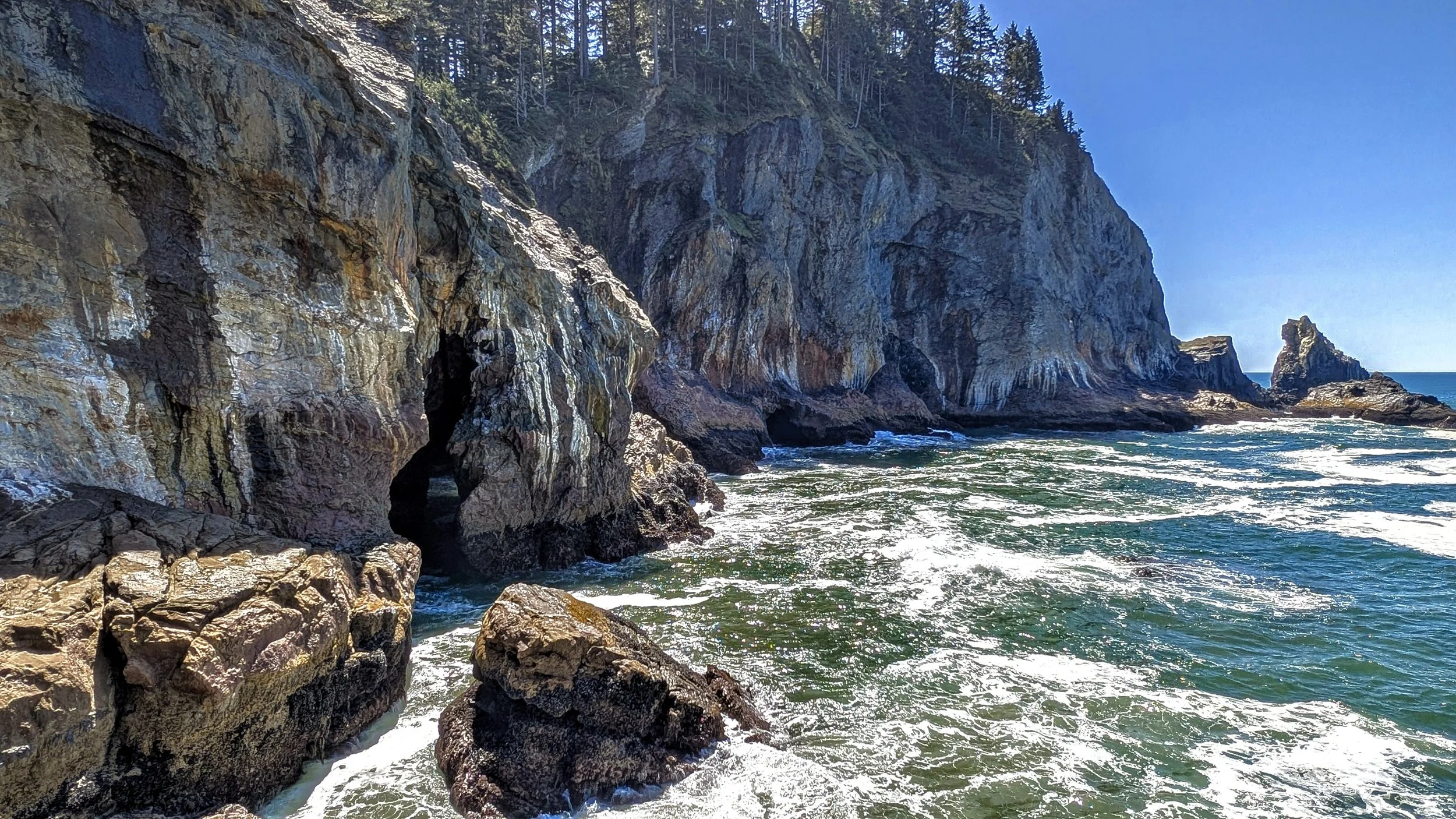
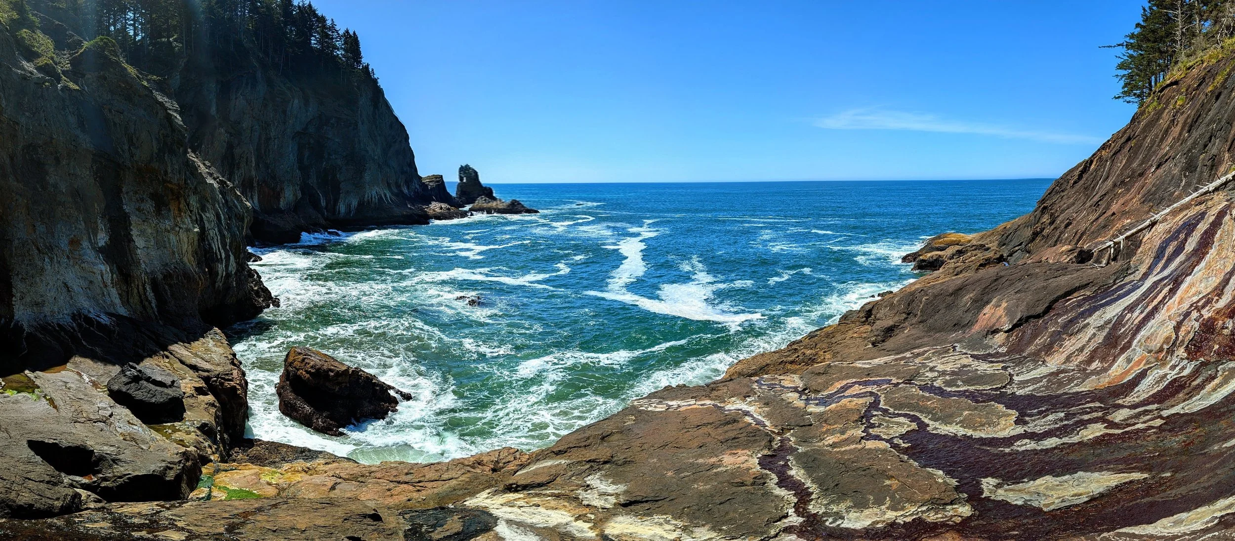
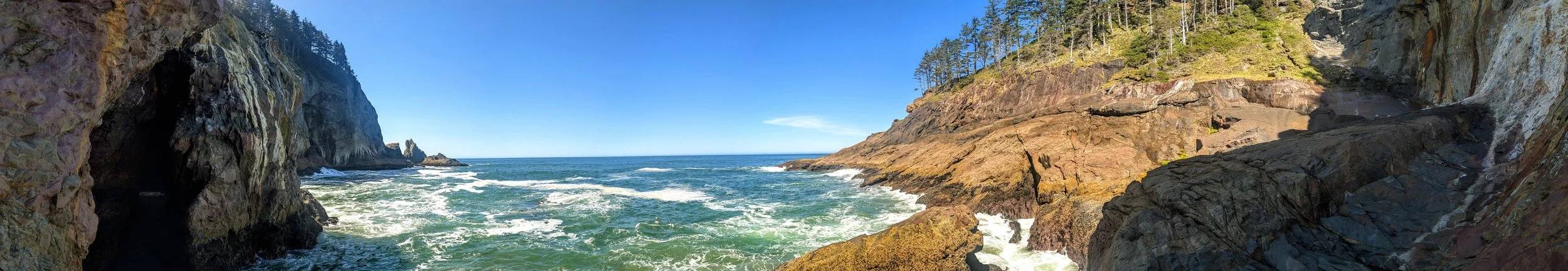
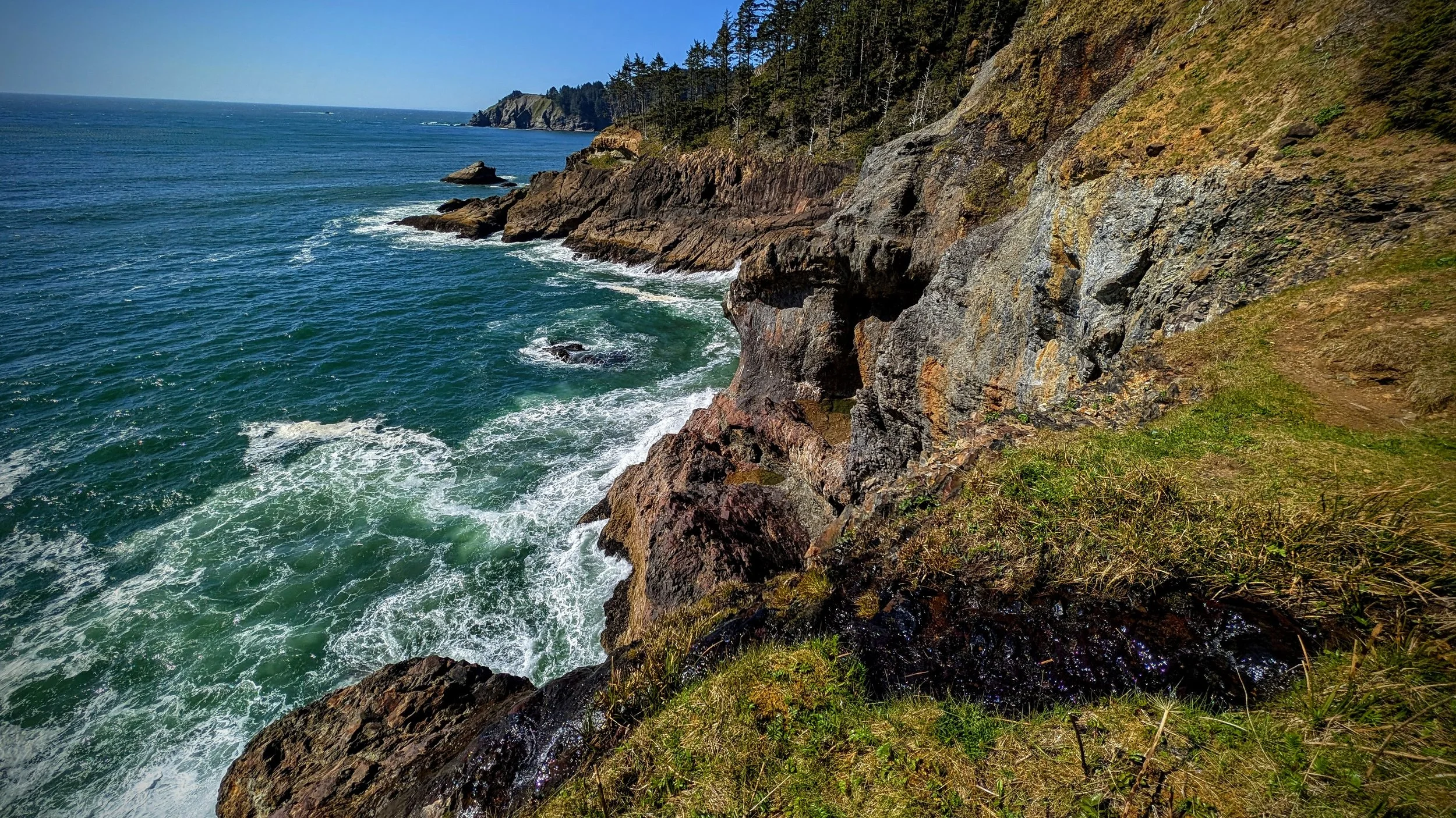
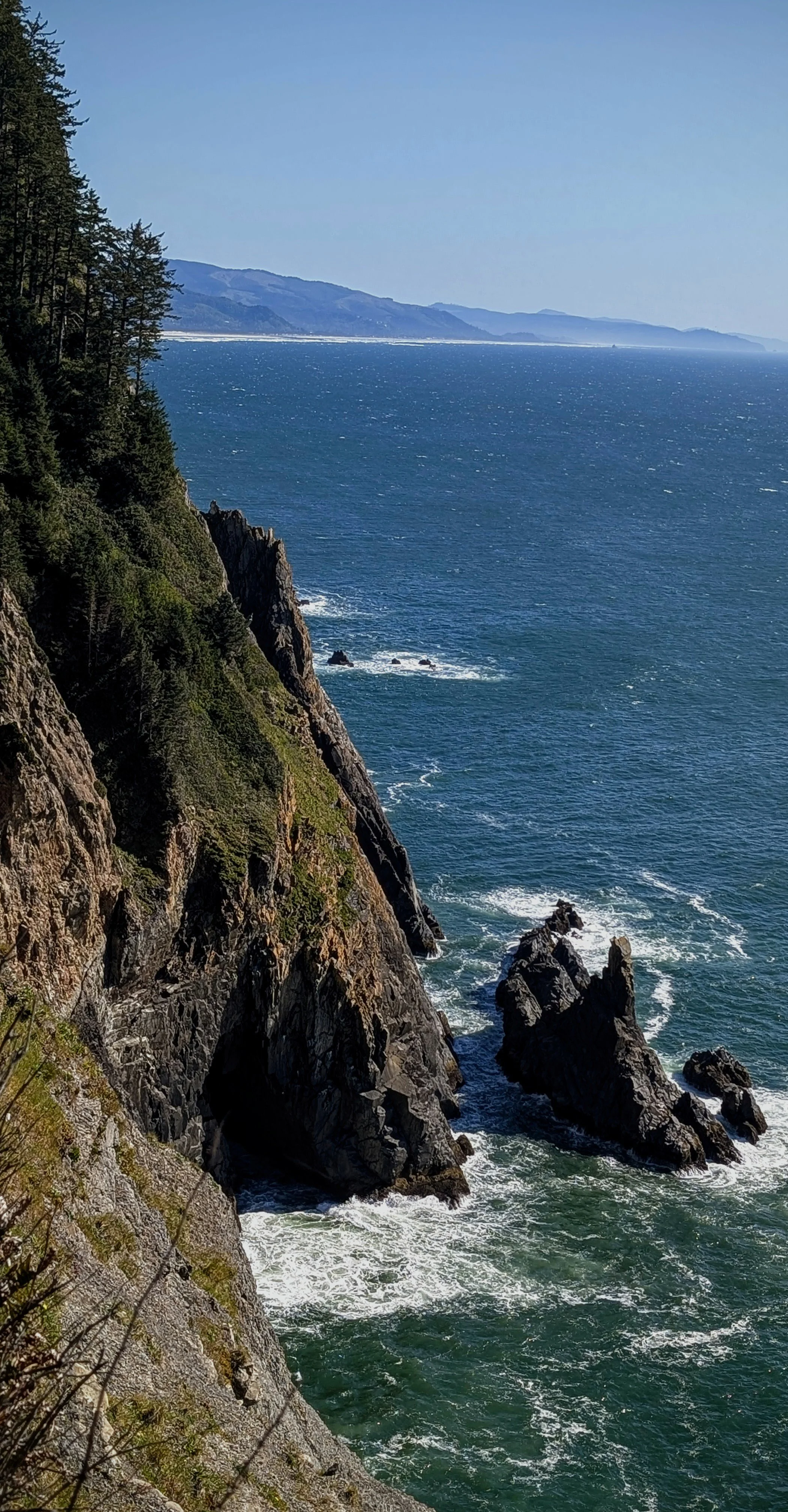
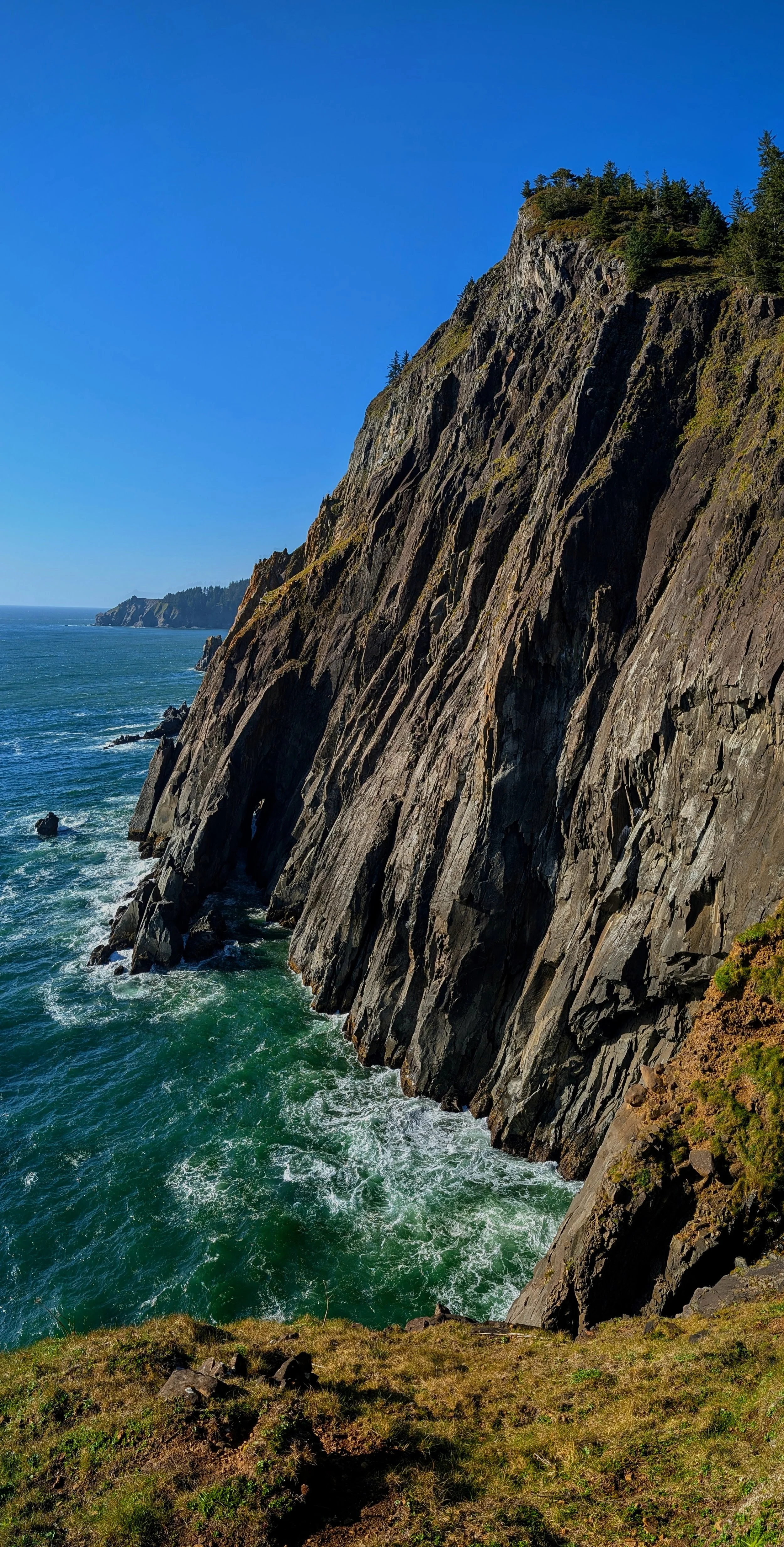
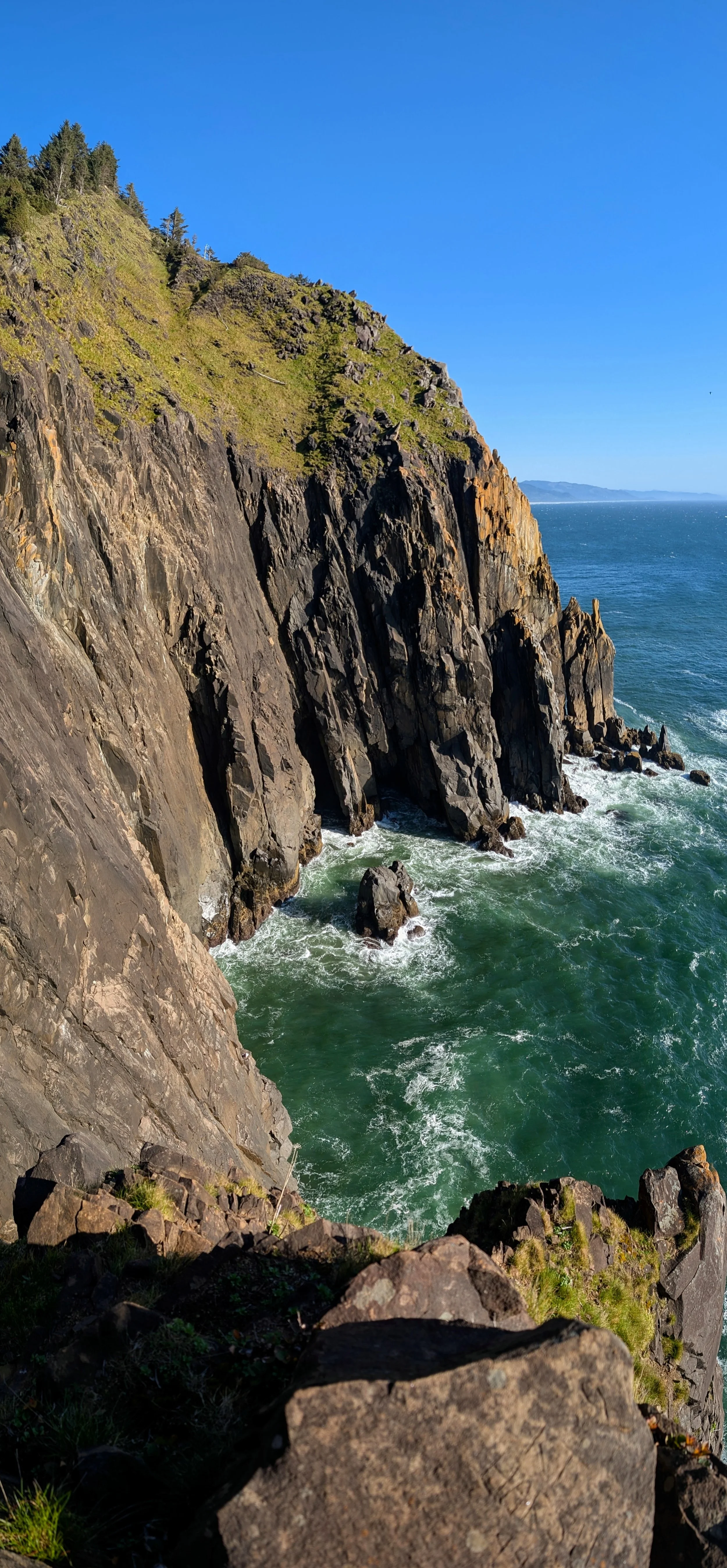
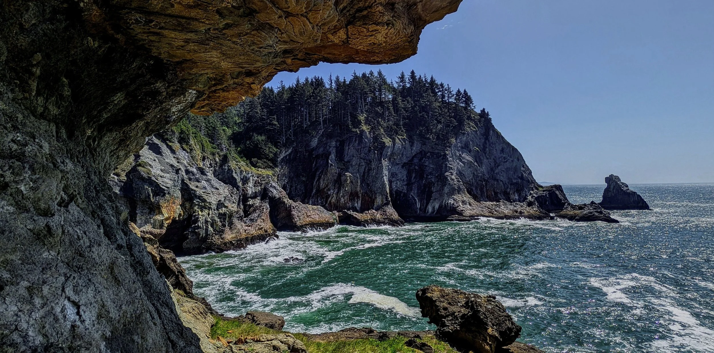
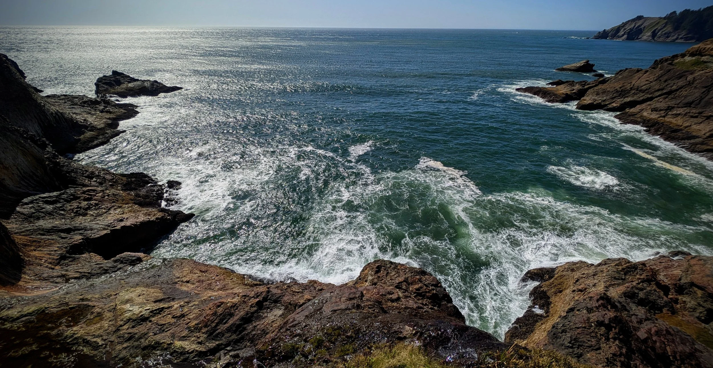
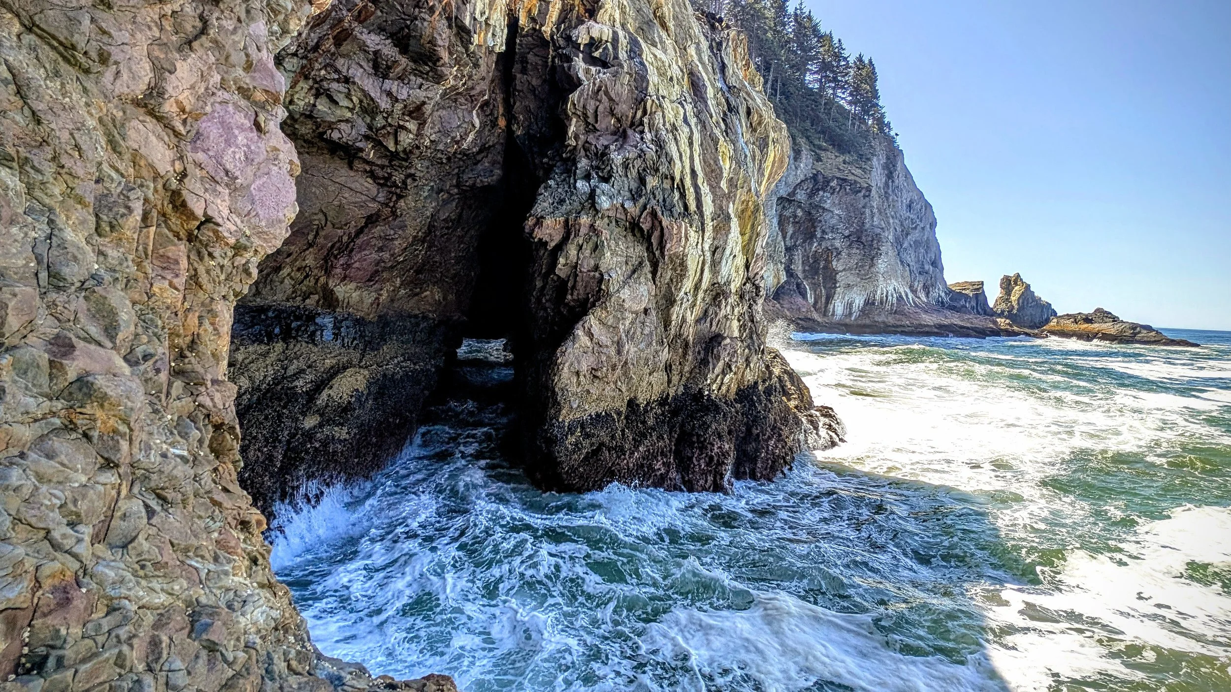
There was really only one long band of volcanic rock that I was able to access. It juts out into the ocean and forms the northern boundary to the cove. The descent takes you out pretty close to the weternmost point, and then you can walk east along the shelf until you get to a huge sea cave/corridor which you can’t access but you can look right into it. It’s the most rugged coastline I’ve ever seen. from that eastern side you can go uphill just a little bit, but it quickly gets steep and you’re looking straight up to the cliff I mentioned right after I left the trail.
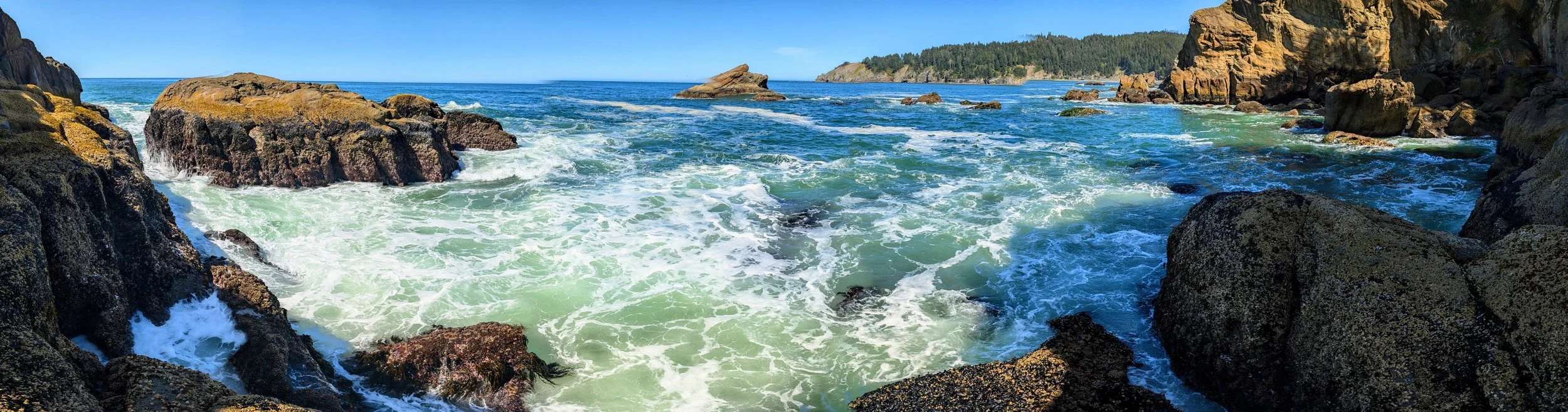
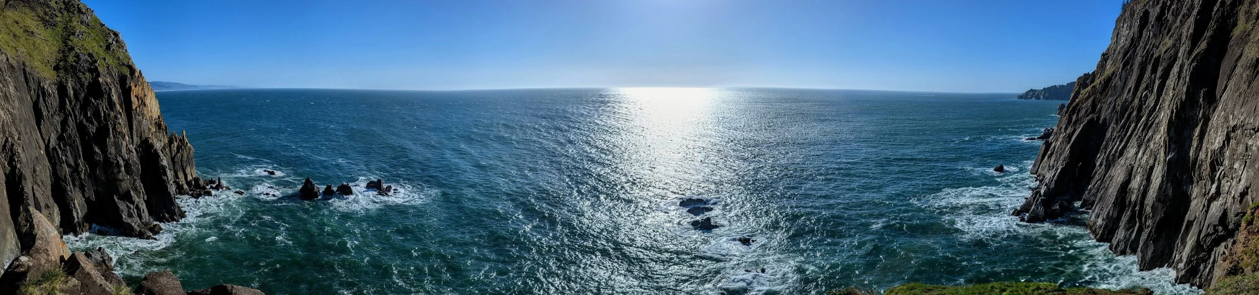
There was really nowhere to go but back along the shelf to the west. I stood on the westermost point and had a really great view back towards Short Sands Beach and Blumenthal Falls way off in the distance.
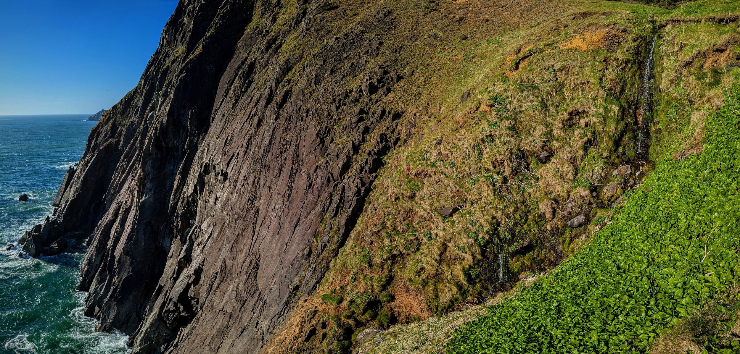
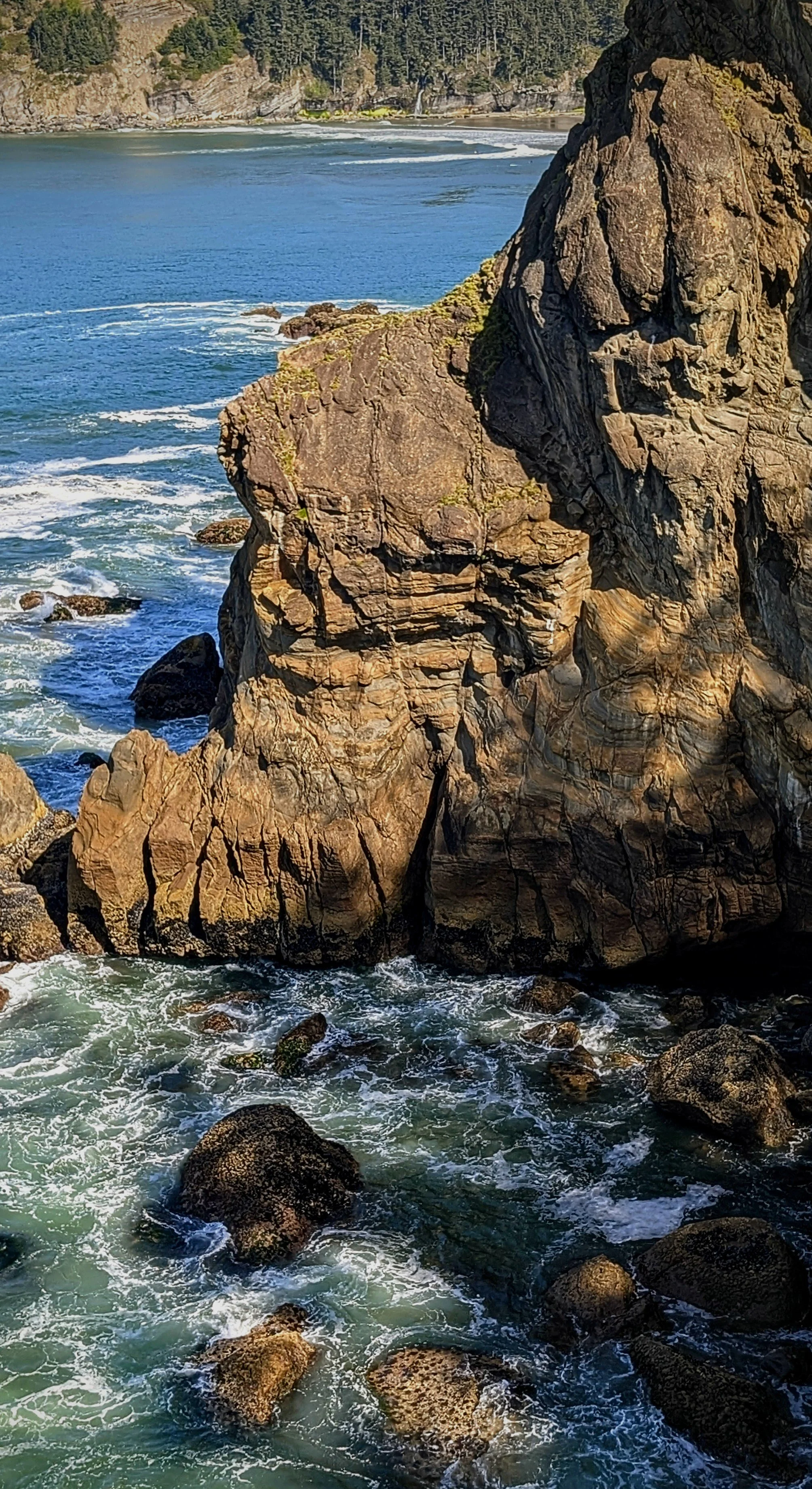
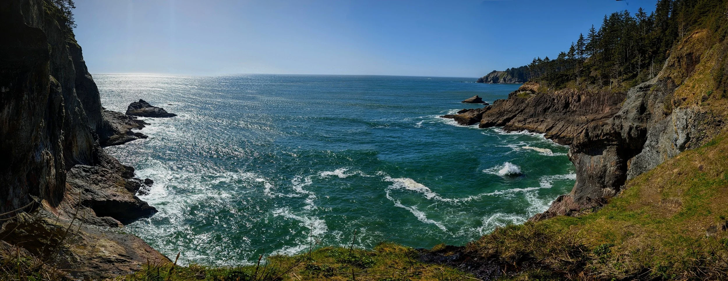
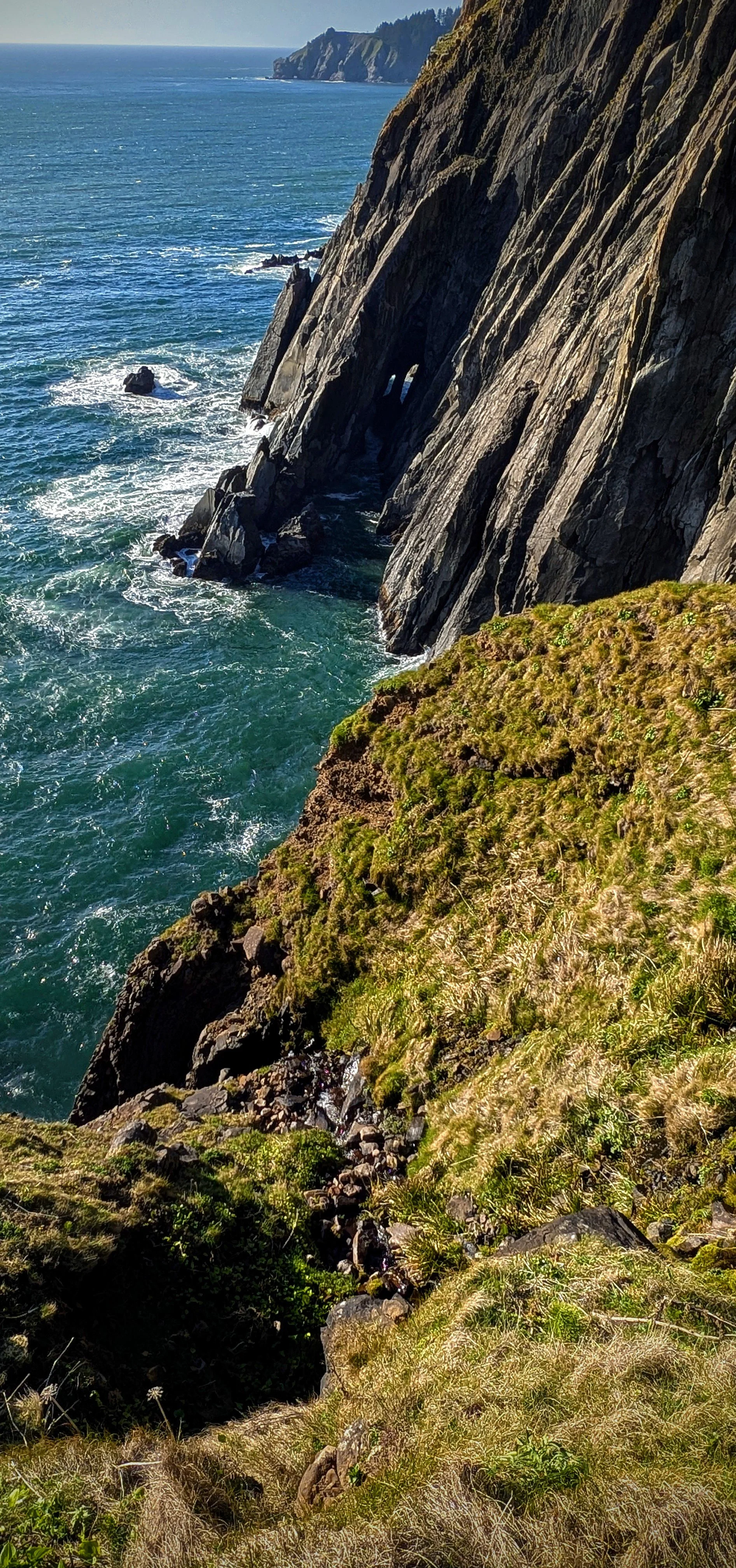
I worked my way north from the westernmost point, down onto another shelf that lets you look into the small inlet just north of the shelf. That inlet is crazy rucked, filled with massive boulders but line with cliffs that I think would make it inaccessible without ropes.
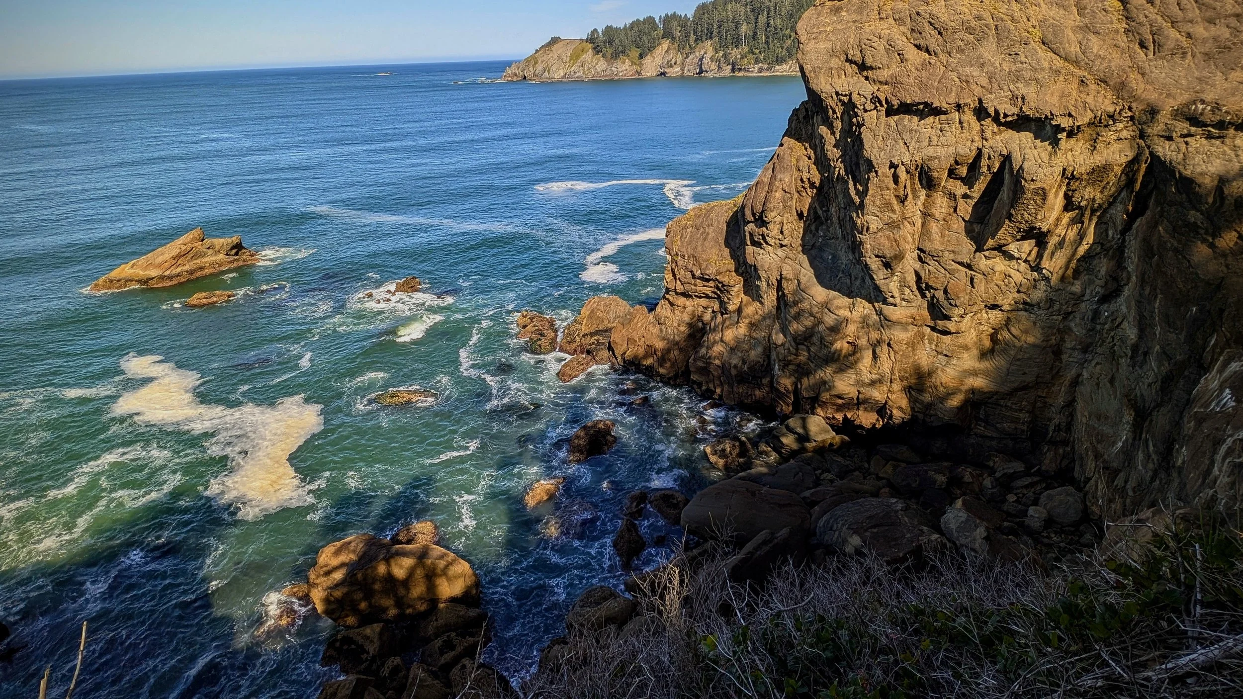
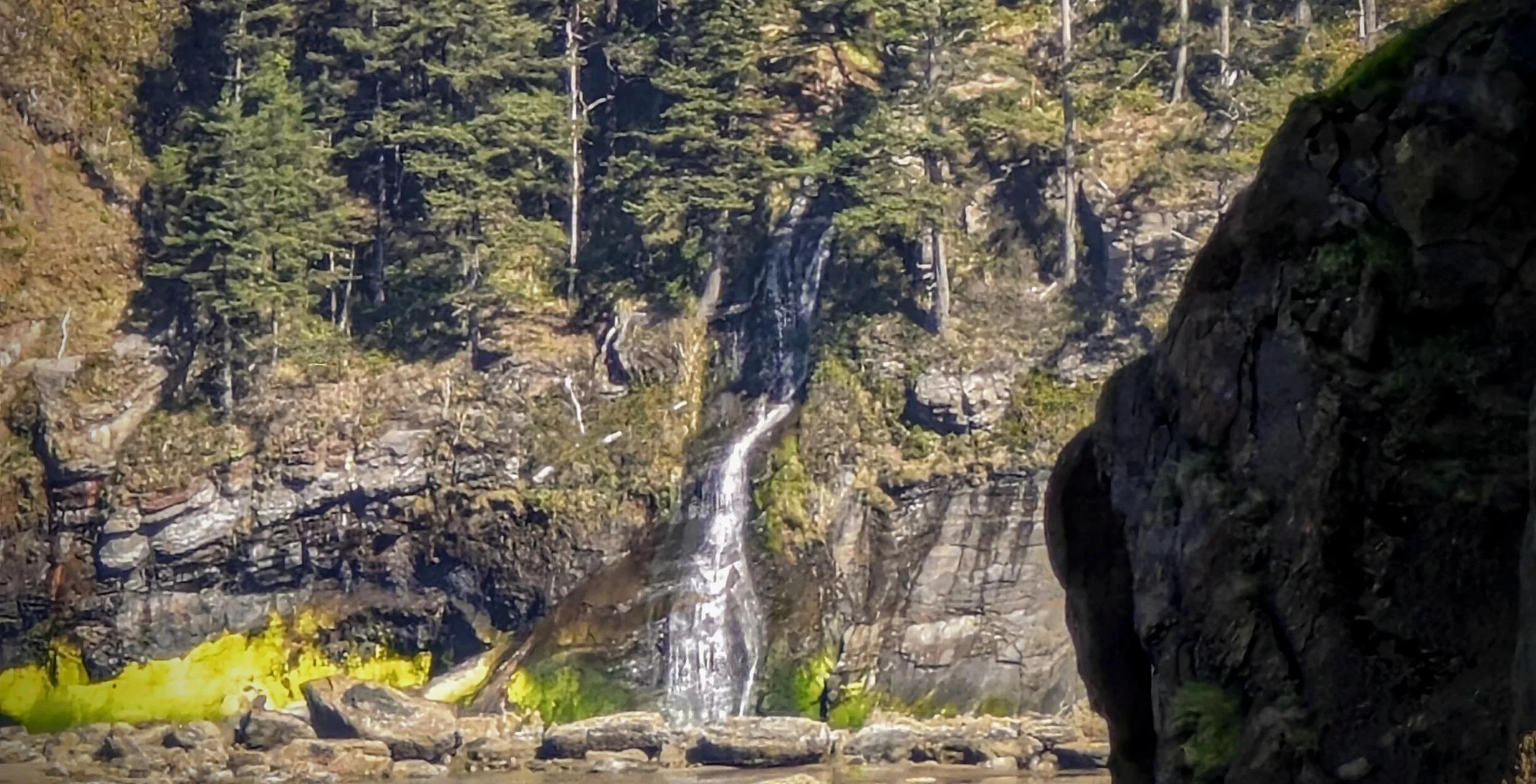
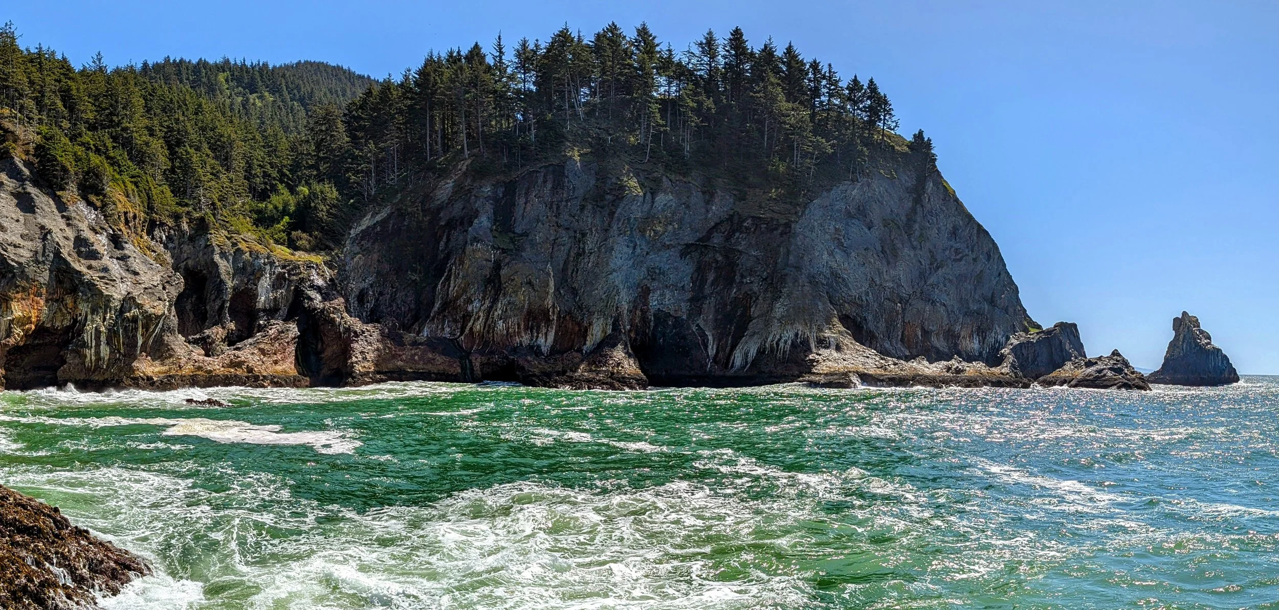
From out on the westernmost point I was able to see to the east side of Devil’s Cauldron, the shoreline south of the big sea cave. Way up above there are a couple little waterfalls dropping down into what looks like it would be a cool tide pool area.
I wasn’t keen to go back up the bushwack, but I finally started back up the hill. It was WAY harder going up. Holy shit it was difficult. But eventually I made it back to the trail and continued south towards Treasure Cove and Elk Flats.
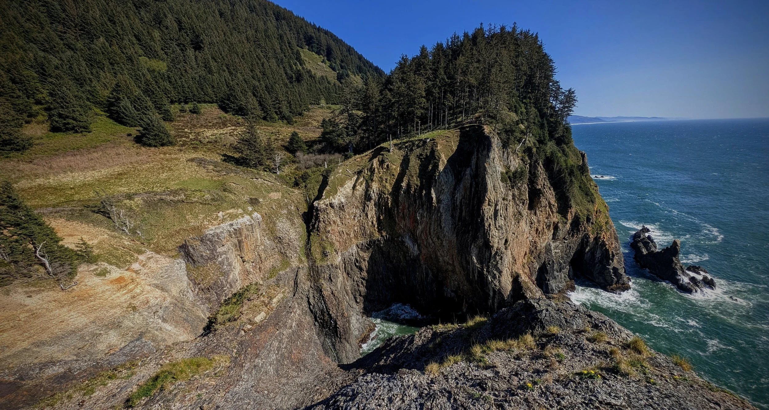
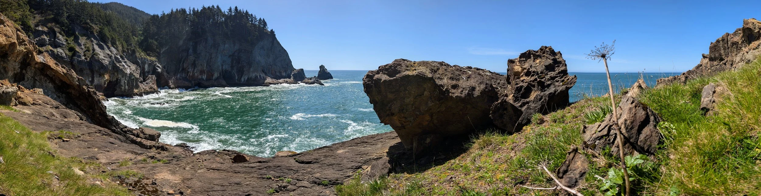
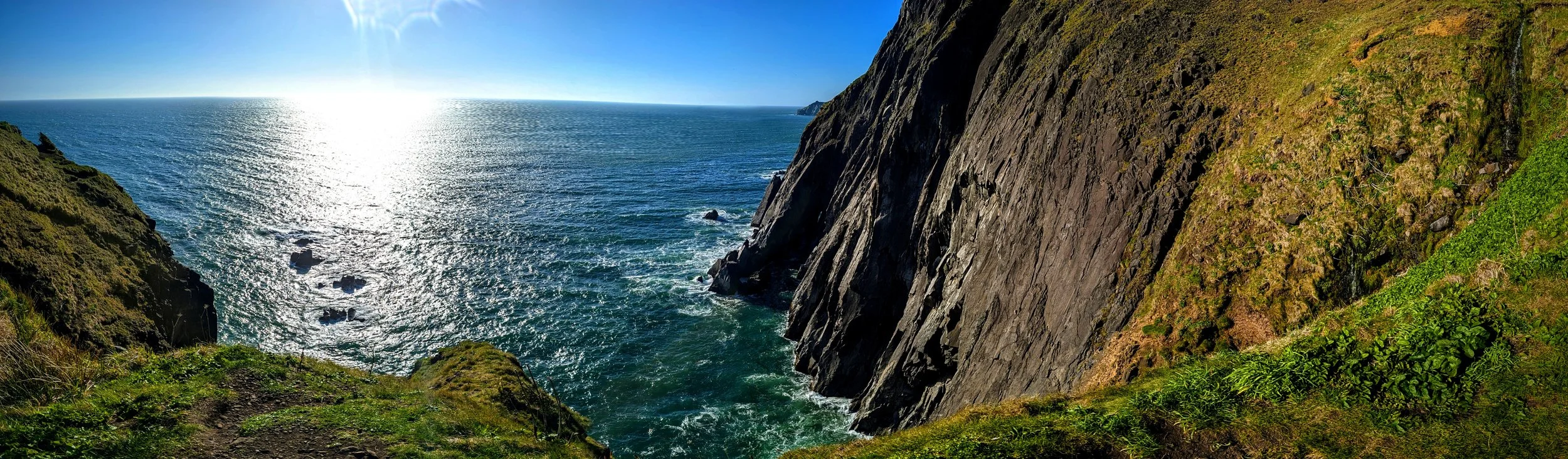
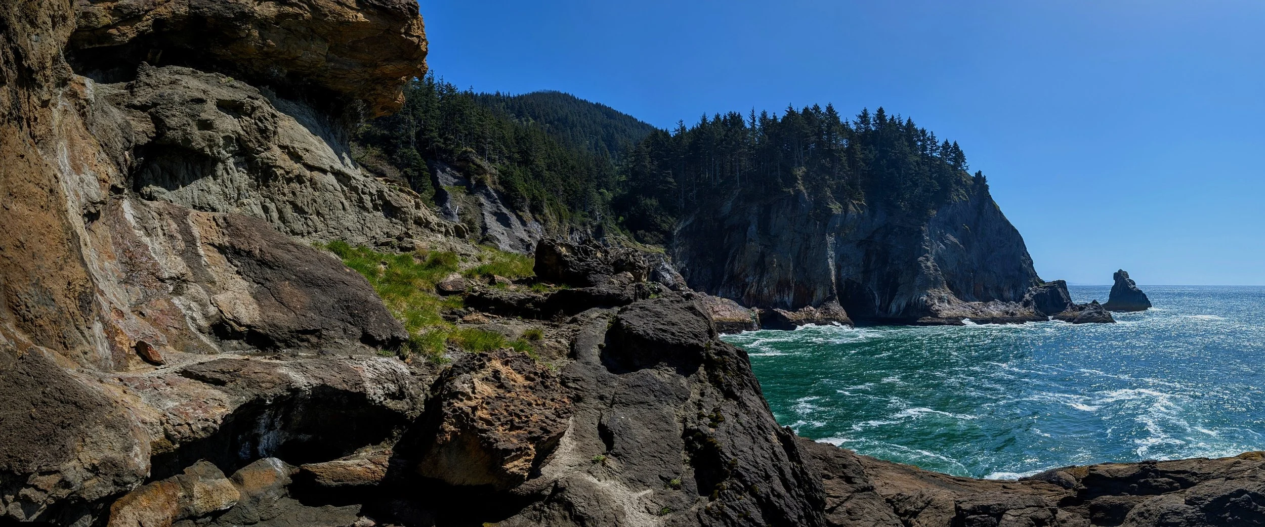
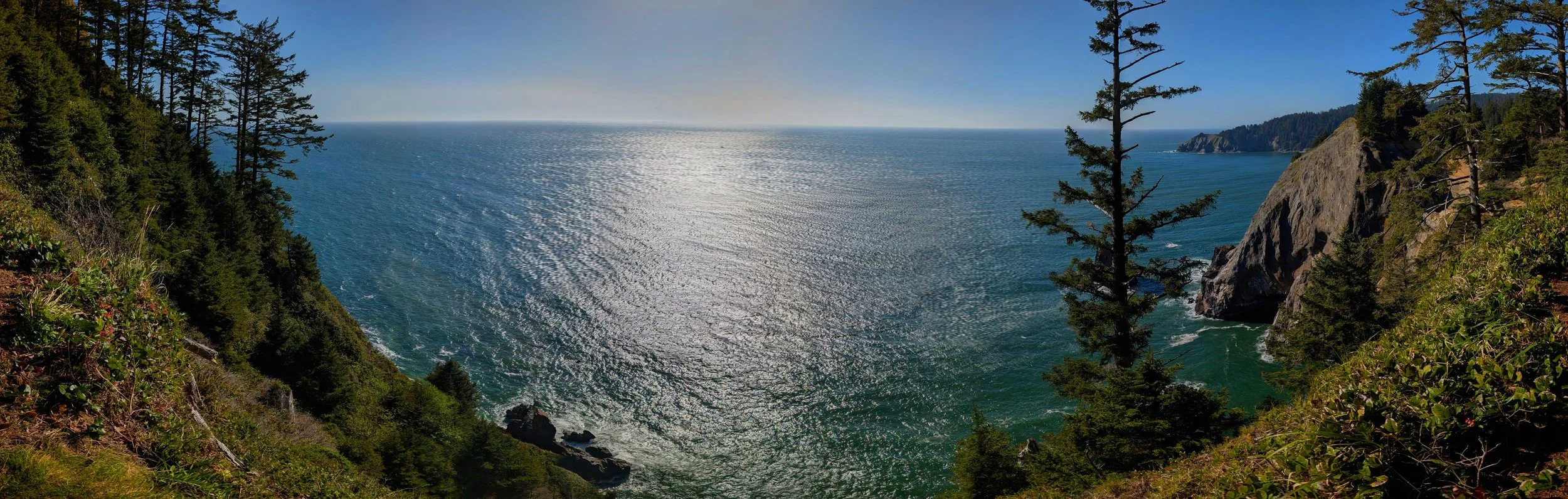
The trail is a ways inland, until eventually it coes back to the cliffs on the south side of Treasure Cove. Before that however, there is a spur trail that takes you west and gives you a view of Devil’s Cauldron from it’s southeast corner.
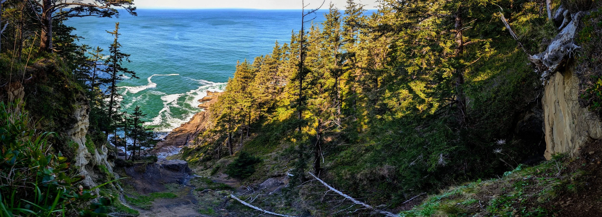
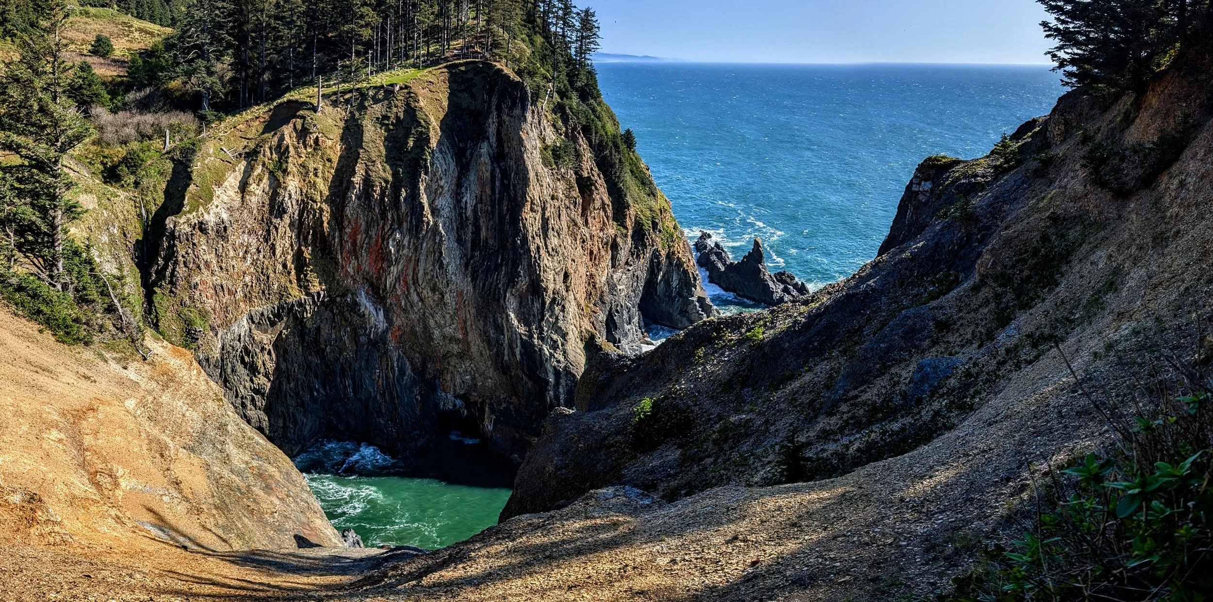
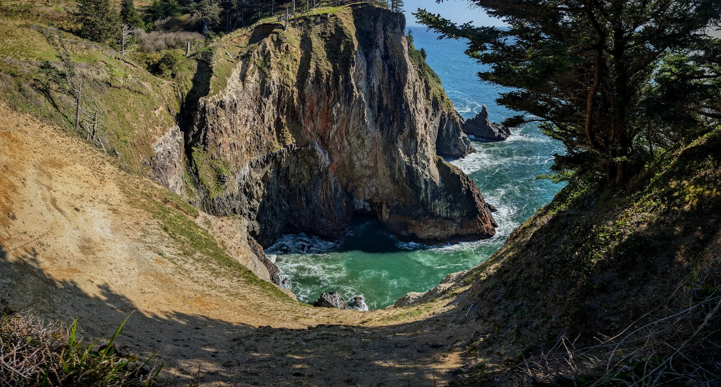
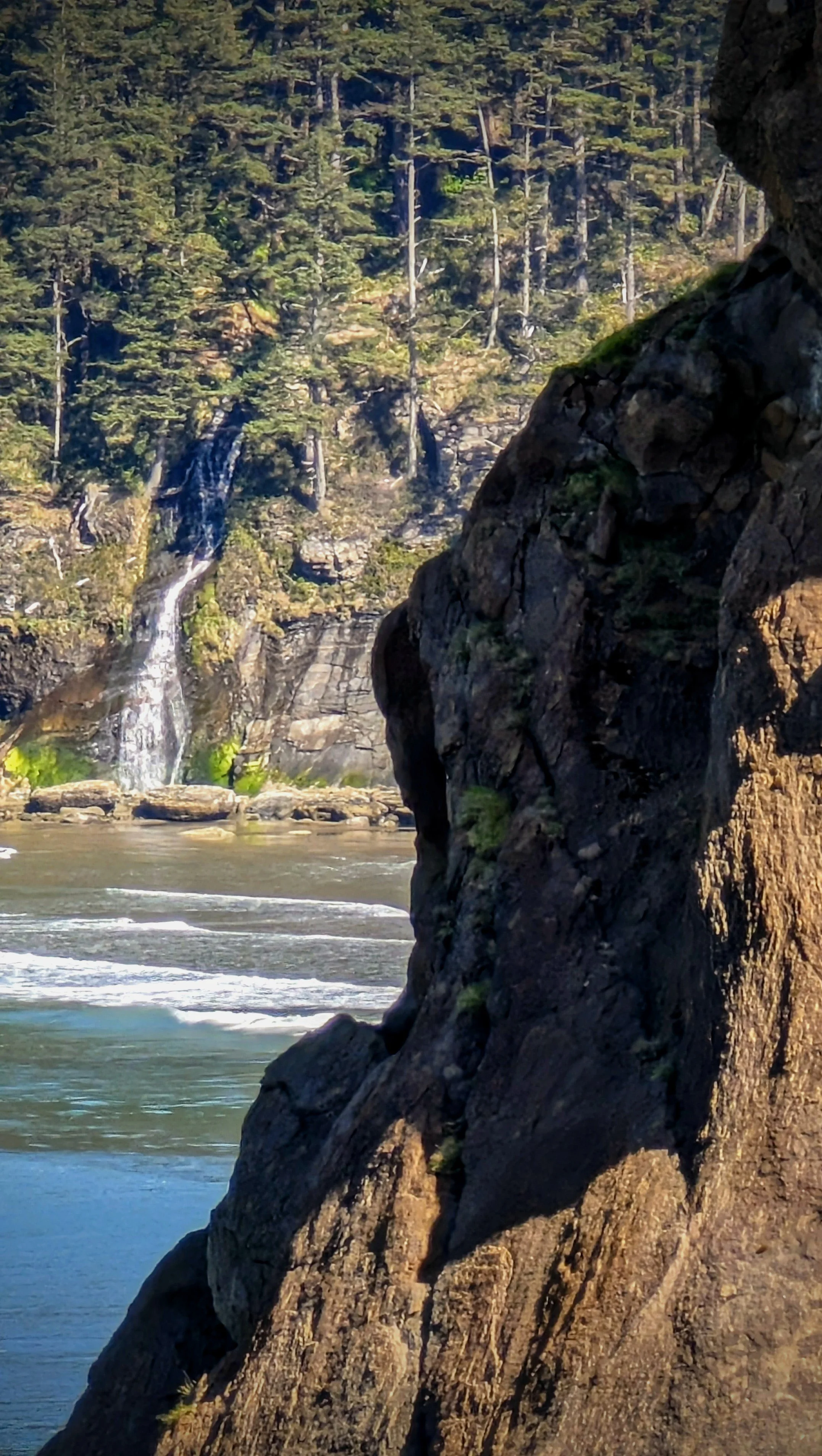
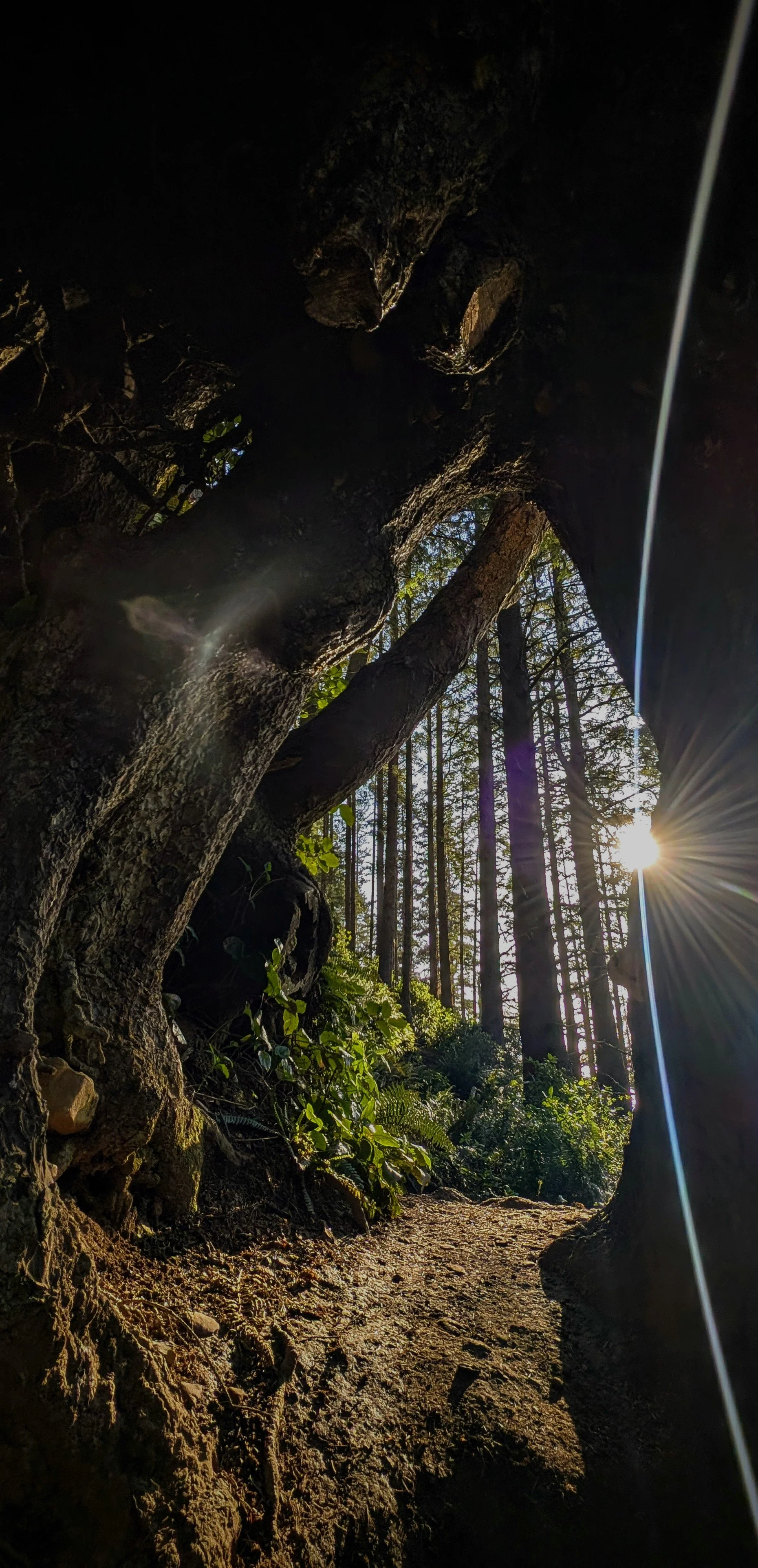
Before you get to that spur trail though, there is a small creek crossing and a tiny little trail takes you west along the creek. I followed that trail down down down and popped out right at the two waterfalls I had mentioned before. I was standing at the top of them looking straight down into Devil’s Cauldron. On my right I could even see into a hole that I believe connects with that long sea cave/corridor. Absolutely wildly rugged cost here!
It was hard to see straight down, but my two waterfalls were tumbling over a cliff down to what I had said looked like tide pool areas. From above they just looked like very rugged rock shelf areas, but I still think there are likely good tide pools down there. I would love to rappel here and find out.
I took some pics that totally do not do it justice, and then went back up the stream to the trail.
I took the spur trail I mentioned, and then tried to connect it up to the next spur trail that runs along the cliffs north and east of Treasure Cove. Connecting the trails meant more bushwacking in this dense stubborn bush. But before too long I was on the trail above Treasure Cove.
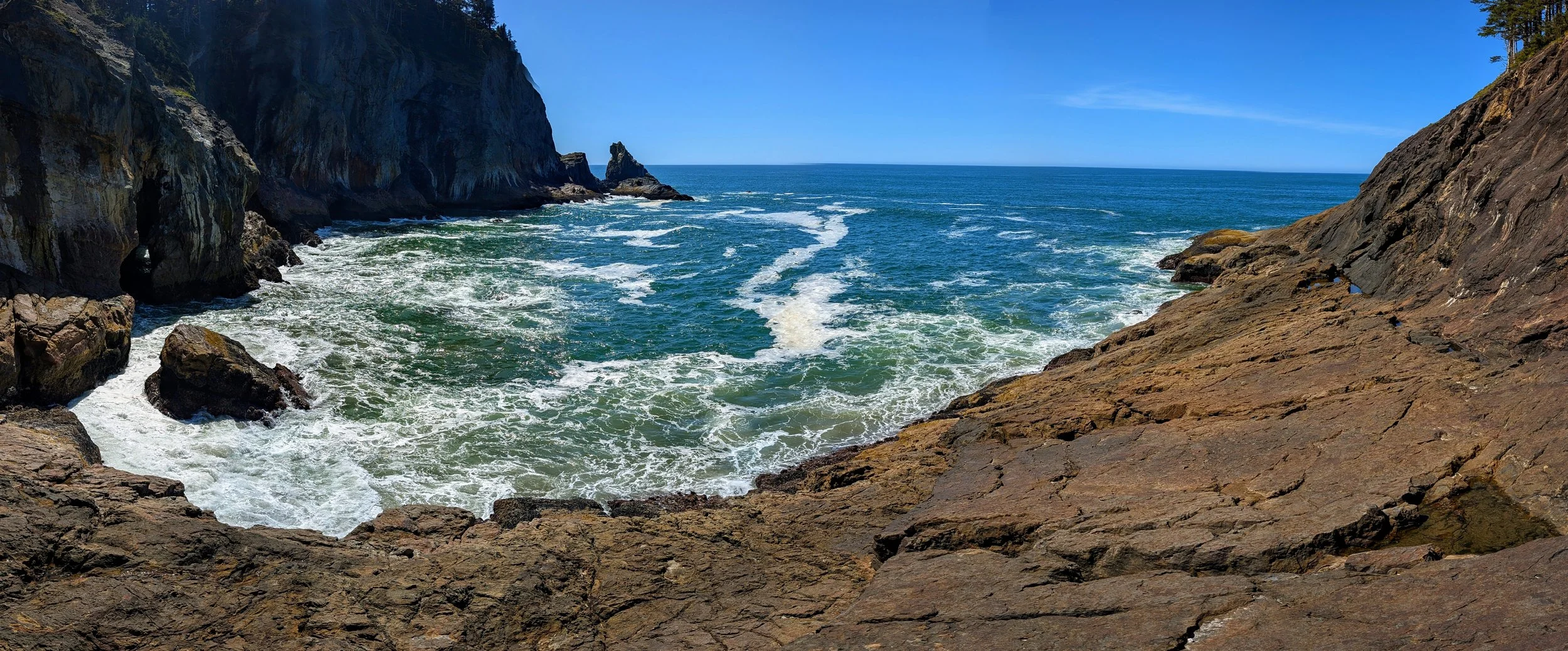
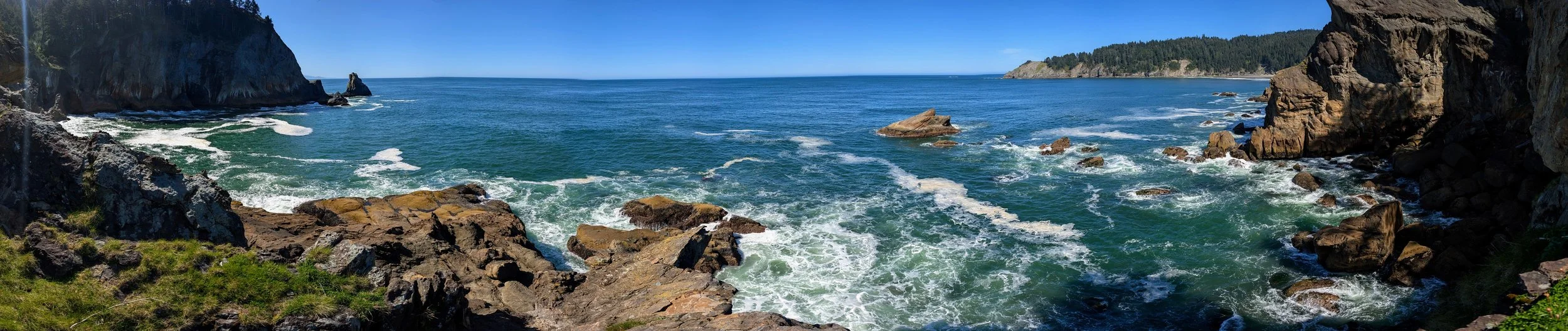
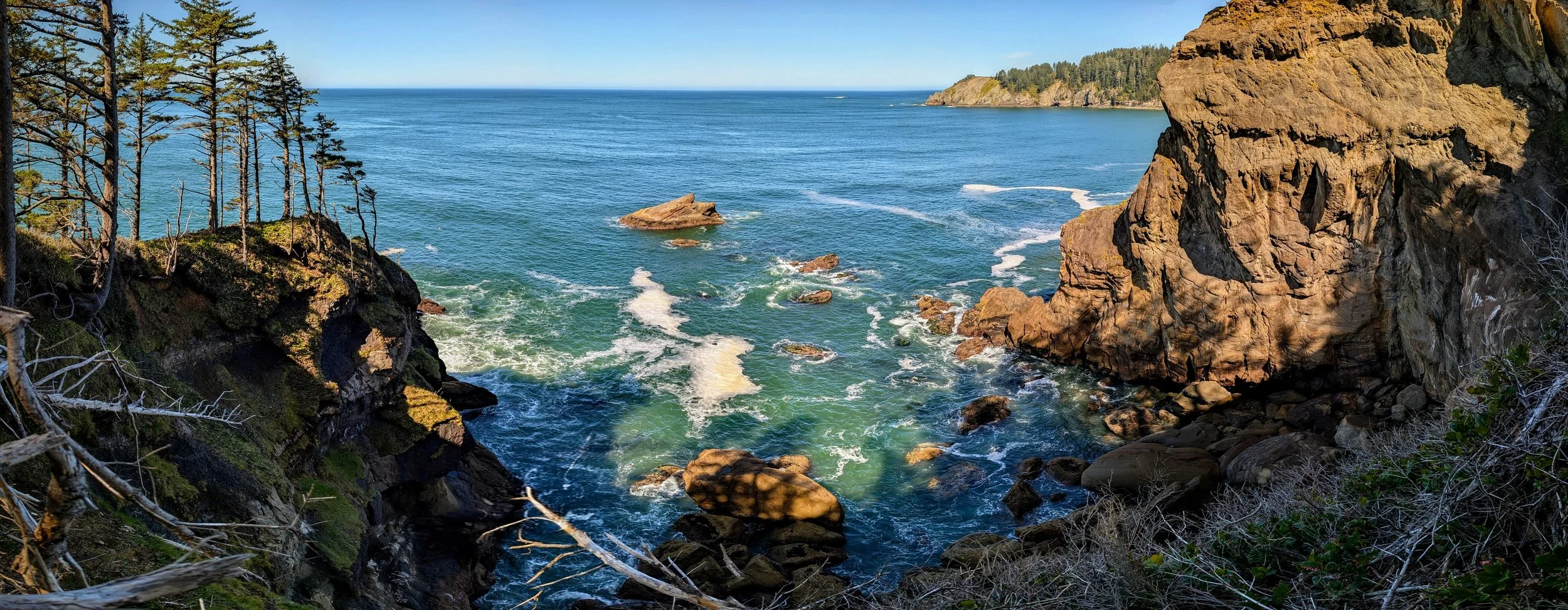
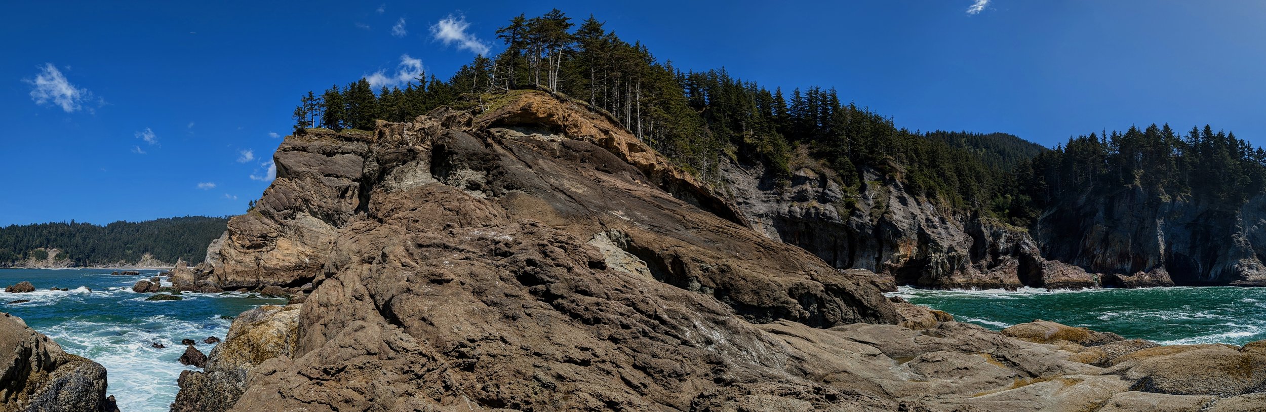
I followed the trail around Treasure Cove and then over to what the map calls the “Devil’s Cauldron Overlook Trail” which again, leads to confusion about what is Devil’s Cauldron and what is Treasure Cove. Again, I think this much smaller inlet, with trails around it, and a park bench on the south side, would be better named Devil’s Cauldron. But all the maps label my innaccessible cove as Devil’s Cauldron and this one with the park bench is labeled Treasure Cove.
Anyway, I then started up over the big headland towards the Elk Flats overlook, then realized I had forgotten my treckking pole, and went back for it. At this point I was getting worn out, and I was worried abotu timing, so I just took the Elk Flats Overlook Trail over to the Elk Flats Viewpoint rather than going up over the big headland.
When I got to the viewpoint there was a wedding photography party just leaving. Must have been aazing wedding pics!
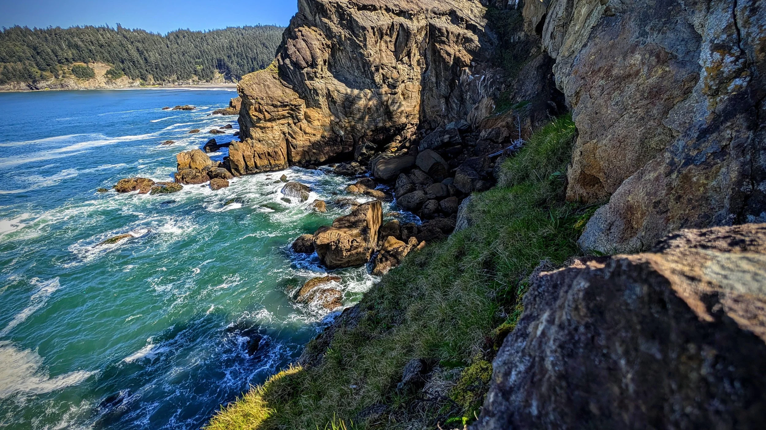
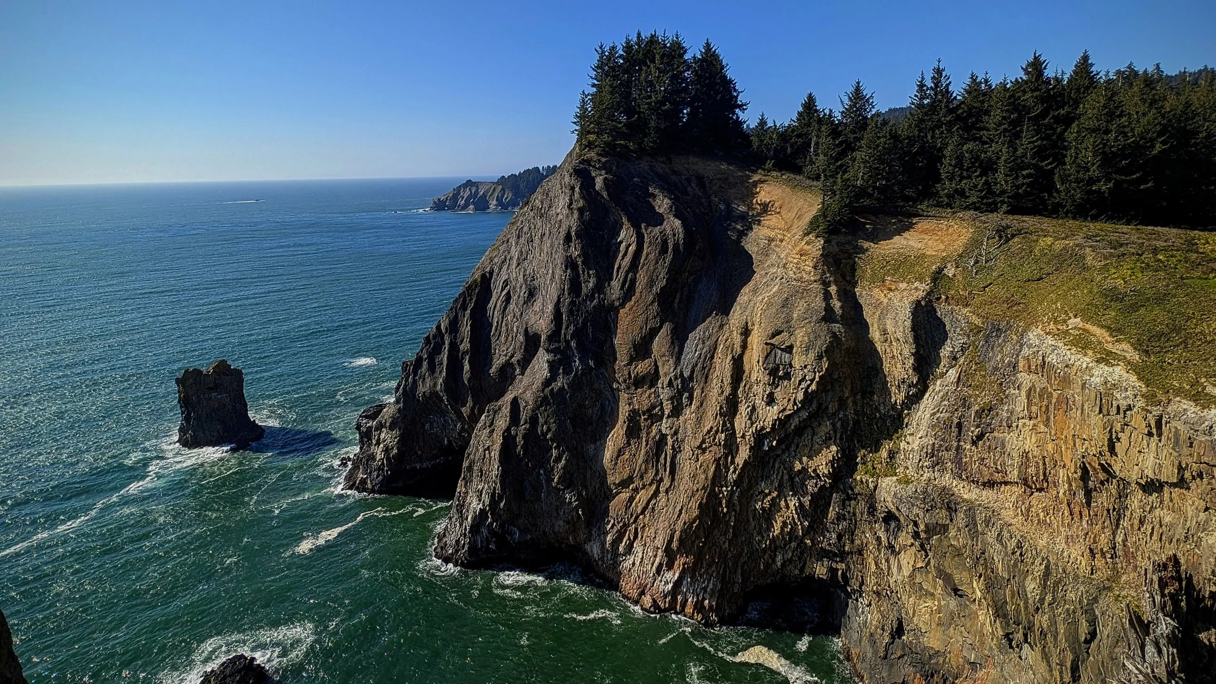
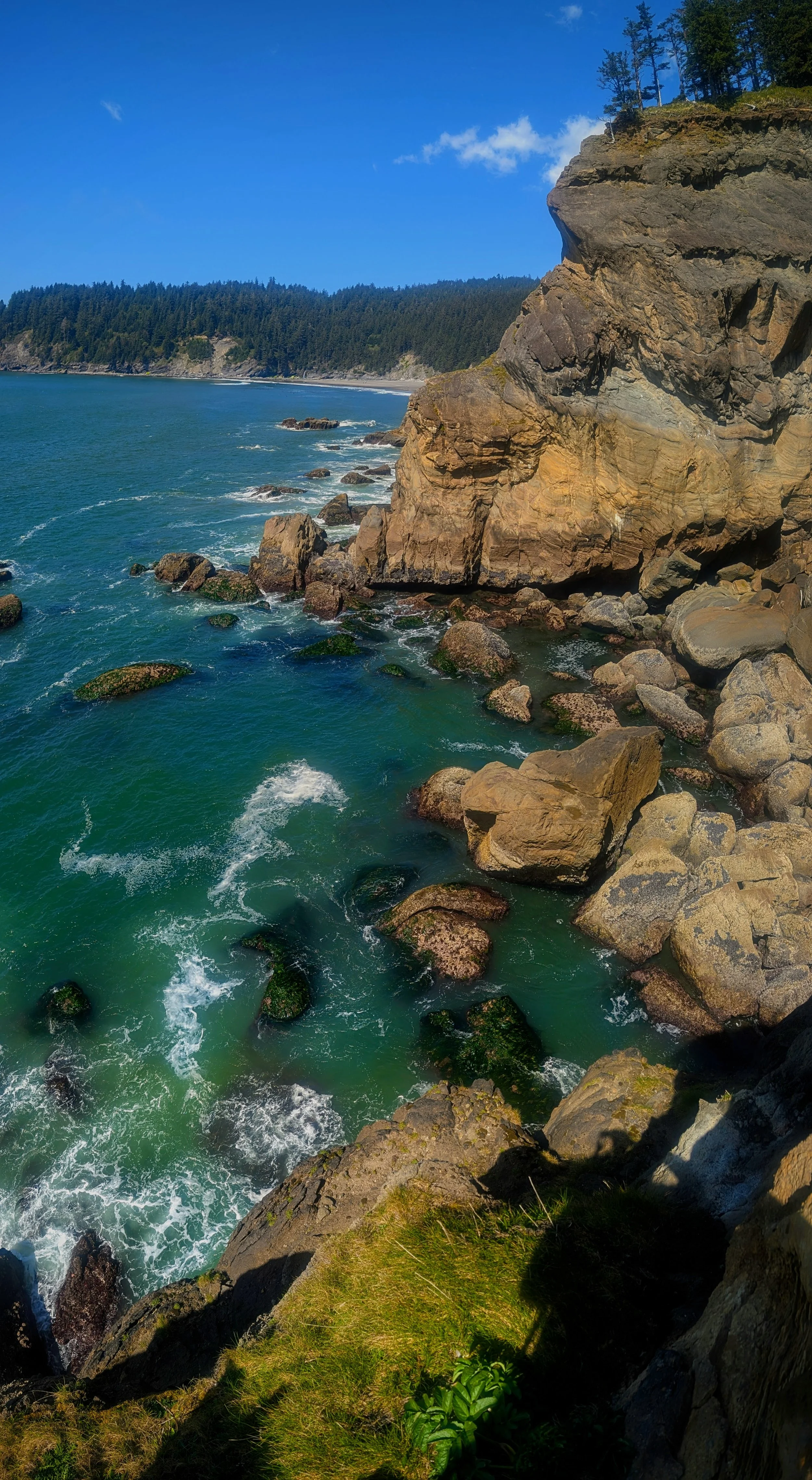
So the Elk Flats Viewpoint is fairly instagram famous, but I don’t know if it actually has a name. It’s the southernmost point on the Elk Flats Trail but it definitely doesn’t overlook any Elk Flats. It overlooks an insane cliff area which our family calls “The Cliffs of Insanity” after the cliffs in the Princess Bride.
My guess is that the actual Elk Flats is the area between Treasure Cove and this viewpoint and the Elk Flats Parking Area. But I couldn’t say for sure.
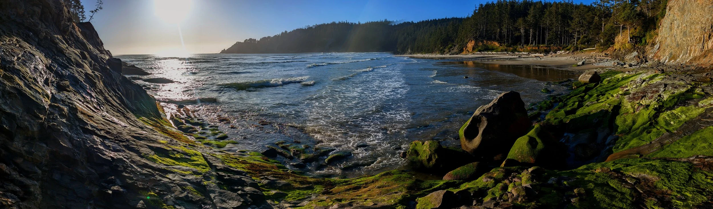
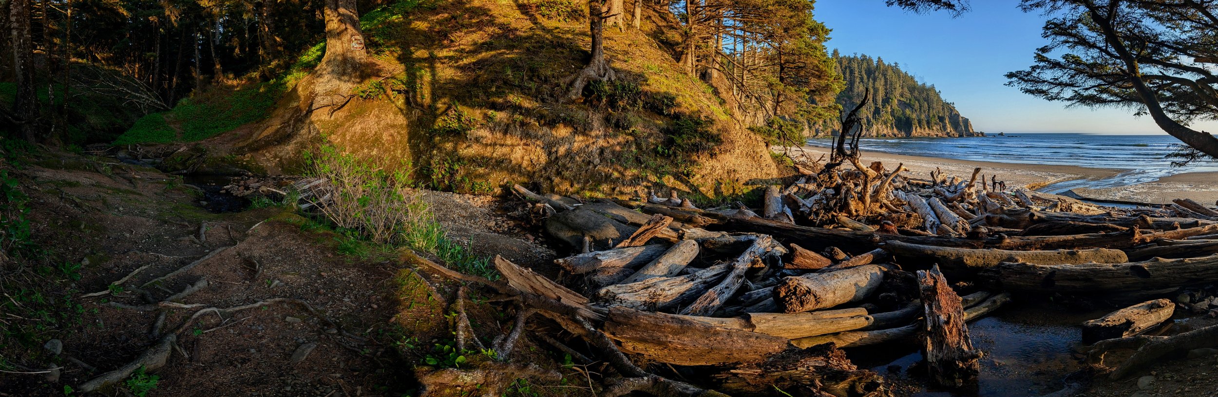
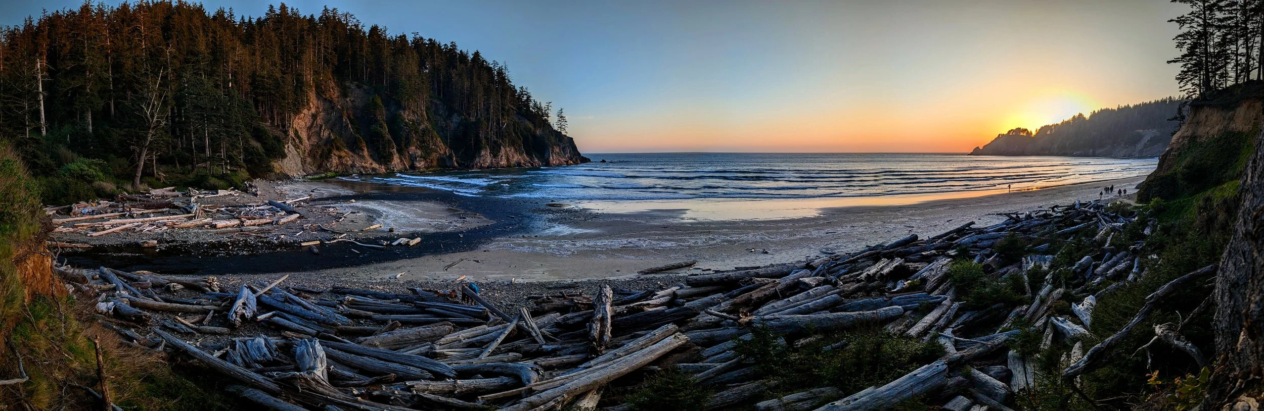
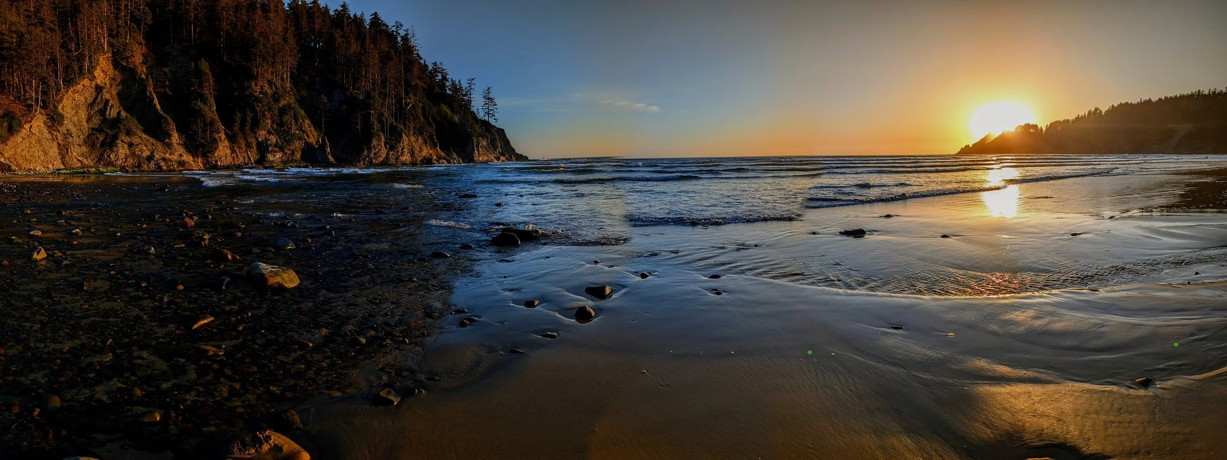
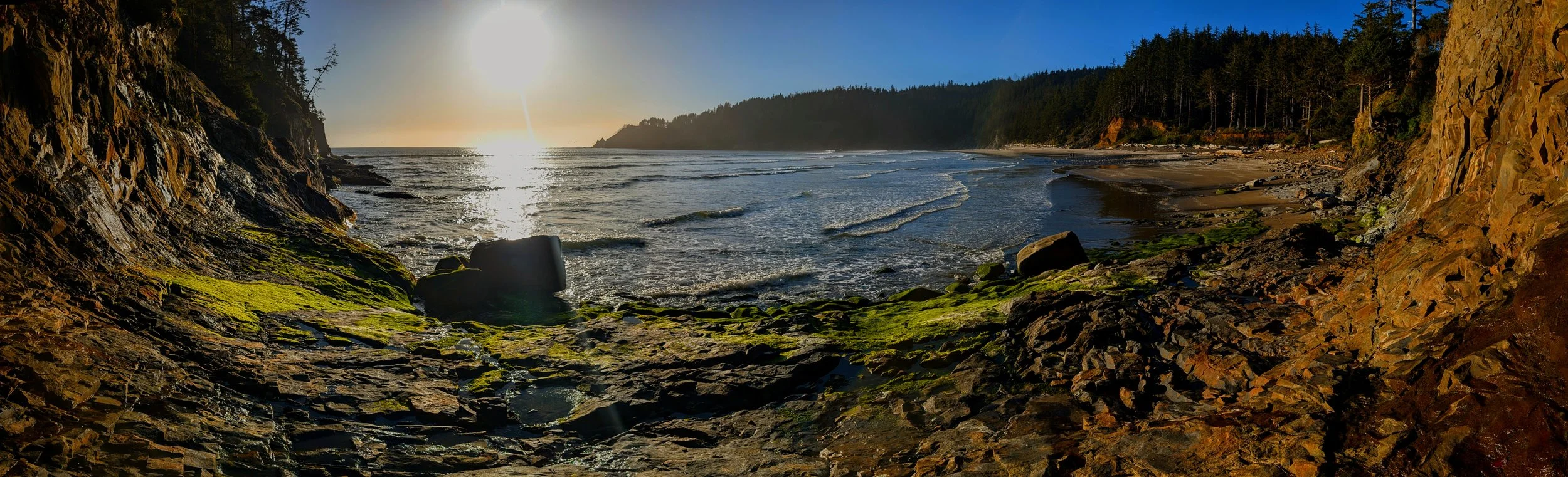
After taking in the view for a while and exploring a tiny bit in the cliffs I took the trail all the way back down to Short Sands Beach. I explored a little on the south end of the beach and then walked the entire length of the beach up to Blumenthal Falls on the north end. The tide was in so I couldn’t quite reach the falls, but I had been there with the family justa. few days before and we spent a ton of time at the waterfall and beyond it to the west. (the rocky coast turns west here and juts out all the way to Cape Falcon.
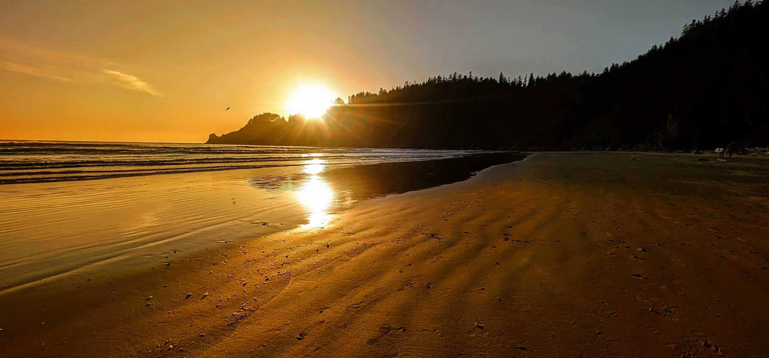
I got some lovely pictures in the golden hour light, and made it back to the car before dark.